Ginger Zee(@Ginger_Zee) 's Twitter Profileg
Ginger Zee

@Ginger_Zee

Chief Meteorologist & Chief Climate Correspondent at ABC News; #NotAWeatherGirl ;author Natural Disaster & Chasing Helicity; host “Hearts of Heroes”

ID:84194879

linkhttps://abcnews.go.com/US/video/lit-americas-future-90240335 calendar_today22-10-2009 00:02:08

124,9K Tweets

2,2M Followers

2,6K Following

Ginger Zee(@Ginger_Zee) 's Twitter Profile Photo

IOWA & MISSOURI: Tornado watch until 6 pm CT; this means conditions are favorable for tornadoes to develop. Now is the time to figure out how you will be near a shelter and when a warning is issued, you get in the shelter immediately.

IOWA & MISSOURI: Tornado watch until 6 pm CT; this means conditions are favorable for tornadoes to develop. Now is the time to figure out how you will be near a shelter and when a warning is issued, you get in the shelter immediately. #Iowa #Missouri #Tornado
account_circle
Ginger Zee(@Ginger_Zee) 's Twitter Profile Photo

Next week I have a big story on ABC News Live about climate intervention (and solar geoengineering). Looking at marine cloud brightening & stratospheric aerosol injection. Preparing myself now for the level of attack I got (still get) from the cloud seeding story last year.

account_circle
Ginger Zee(@Ginger_Zee) 's Twitter Profile Photo

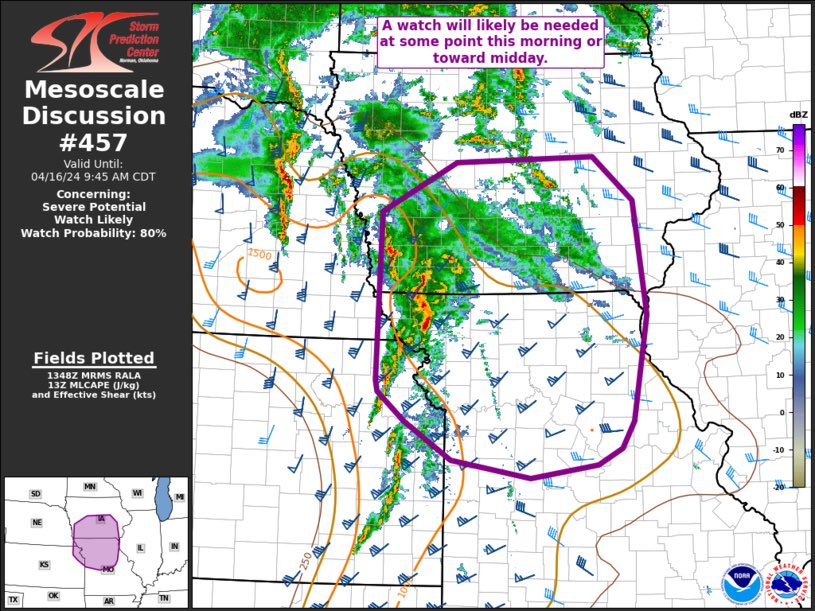
9 am CT: IOWA AND MISSOURI: if you live inside the purple lines - please be weather aware, you’ll likely get a severe thunderstorm watch soon. Conditions are becoming more favorable to sustain the storms that have been in Kansas & Nebraska with damaging winds/tornadoes.

9 am CT: IOWA AND MISSOURI: if you live inside the purple lines - please be weather aware, you’ll likely get a severe thunderstorm watch soon. Conditions are becoming more favorable to sustain the storms that have been in Kansas & Nebraska with damaging winds/tornadoes.
account_circle
Ginger Zee(@Ginger_Zee) 's Twitter Profile Photo

There is no geo engineering at scale happening in this country …. BUT watch next week and you’ll see me do a story on the experiments/research happening in climate intervention right now! I have a full story on ABC News Live

I did an update on cloud seeding last week!

account_circle
Ginger Zee(@Ginger_Zee) 's Twitter Profile Photo

The only solution to plastic water bottles is not using them/not buying them … recycling is not the answer. Same for us- RO! And just reuse our containers.

account_circle
Ginger Zee(@Ginger_Zee) 's Twitter Profile Photo

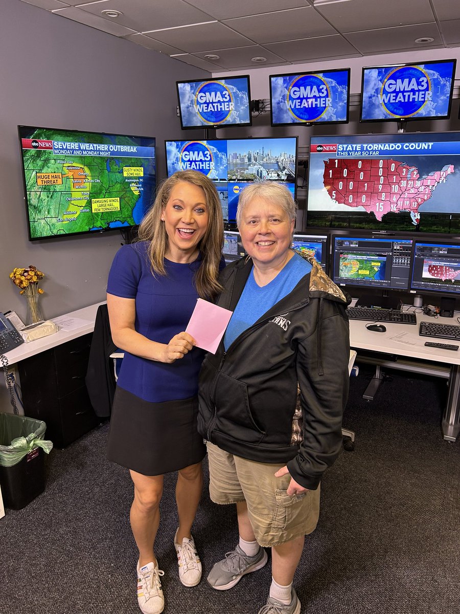
See that note pad I’m holding? It’s made by this GREEN QUEEN, my coworker at Good Morning America Cap who upcycles old scripts & rundowns so we all have little scratch pads.

She saw a waste-problem and made a solution, up cycling before we recycle.

See that note pad I’m holding? It’s made by this GREEN QUEEN, my coworker at @GMA Cap who upcycles old scripts & rundowns so we all have little scratch pads. She saw a waste-problem and made a solution, up cycling before we recycle. #thepowerofus #earthmonth #reuse #reduce
account_circle
Ginger Zee(@Ginger_Zee) 's Twitter Profile Photo

How is it that all we need is one warm day and the bugs come out like it’s mid-summer? Took Brando for a walk today and could not believe the amount of flying insects. Is there gestation 30 seconds or something?

account_circle
Ginger Zee(@Ginger_Zee) 's Twitter Profile Photo

Virginia, Maryland and Delaware: beware you are in a severe thunderstorm watch if in highlighted areas. That means conditions are favorable for thunderstorms with large hail and winds in excess of 60 mph. Washington DC in severe thunderstorm watch, including many others

account_circle
Ginger Zee(@Ginger_Zee) 's Twitter Profile Photo

In less than a week - I’ll take you to New Mexico where I learned how to build & live in an Earthship— it’s more than a home, it’s a living vessel built INTO the earth. Fully off grid, made from recycled materials (here I am learning how they use gravel & tires for their main…

account_circle
Ginger Zee(@Ginger_Zee) 's Twitter Profile Photo

Monday mid-Atlantic T-storm risk:

Virginia, Maryland & North Carolina: damaging winds in excess of 60 mph possible later today! Max Golembo
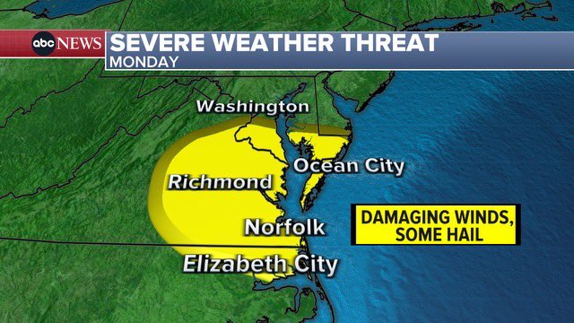
Monday mid-Atlantic T-storm risk: Virginia, Maryland & North Carolina: damaging winds in excess of 60 mph possible later today! @Wx_Max
account_circle
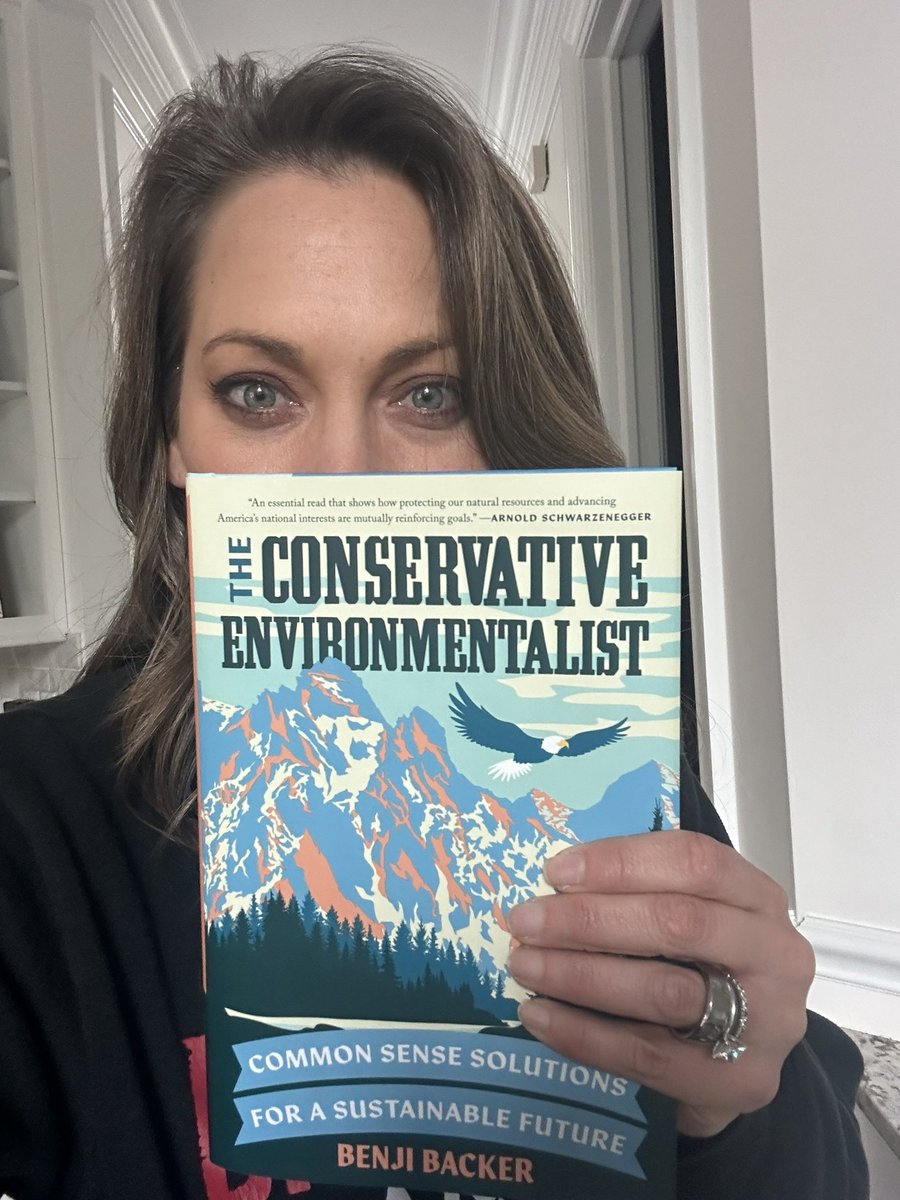
Benji Backer(@BenjiBacker) 's Twitter Profile Photo

When people say we can’t reduce carbon emissions unless we stop economic growth and ban specific energy sources, don’t believe them.

account_circle
Ginger Zee(@Ginger_Zee) 's Twitter Profile Photo

Tornado risk ramps up Tuesday for Iowa, Missouri & Illinois. Look at the tornado county by state so far this year… Ohio in the lead. Dan Amarante Max Golembo Kenton Gewecke
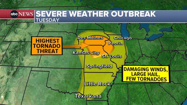
Tornado risk ramps up Tuesday for Iowa, Missouri & Illinois. Look at the tornado county by state so far this year… Ohio in the lead. @DanAmarante @Wx_Max @KentonGewecke
account_circle
Ginger Zee(@Ginger_Zee) 's Twitter Profile Photo

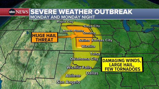
MONDAY/MONDAY NIGHT SEVERE STORMS:

Lincoln & Grand Island, NE
Salina, Manhattan & Hutchinson, KS

large hail is highest risk, tornadoes & damaging wind too! Kansas City, OKC, Omaha etc all included.

MONDAY/MONDAY NIGHT SEVERE STORMS: Lincoln & Grand Island, NE Salina, Manhattan & Hutchinson, KS large hail is highest risk, tornadoes & damaging wind too! Kansas City, OKC, Omaha etc all included. #nebraska #kansas #oklahoma #southdakota #texas #Missouri #iowa
account_circle