CTrees (@ctrees_org) 's Twitter Profile
CTrees

@ctrees_org

Nonprofit organization tracking carbon in every tree and forest on the planet.

ID: 1568324216747098112

linkhttps://ctrees.org/ calendar_today09-09-2022 19:43:33

104 Tweet

1,1K Followers

530 Following

Ricardo Dalagnol (@ricardodalagnol) 's Twitter Profile Photo

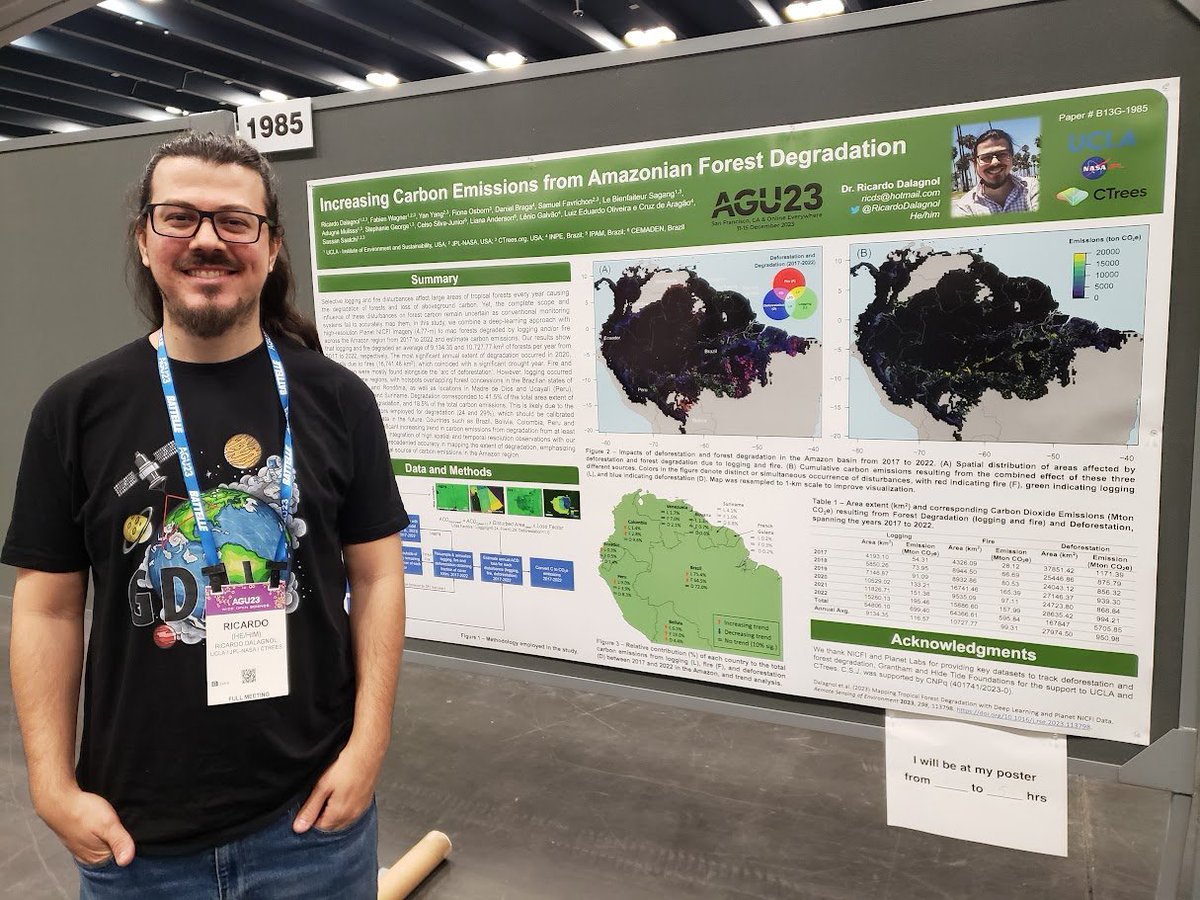
Come and chat about Amazon forest #degradation mapping using #PlanetNICFI and emissions estimates at my poster today in #AGU23. I present some preliminary estimates and would love to discuss ideas on improving and moving forward! : )

Come and chat about Amazon forest #degradation mapping using #PlanetNICFI and emissions estimates at my poster today in #AGU23. I present some preliminary estimates and would love to discuss ideas on improving and moving forward! : )
Ricardo Dalagnol (@ricardodalagnol) 's Twitter Profile Photo

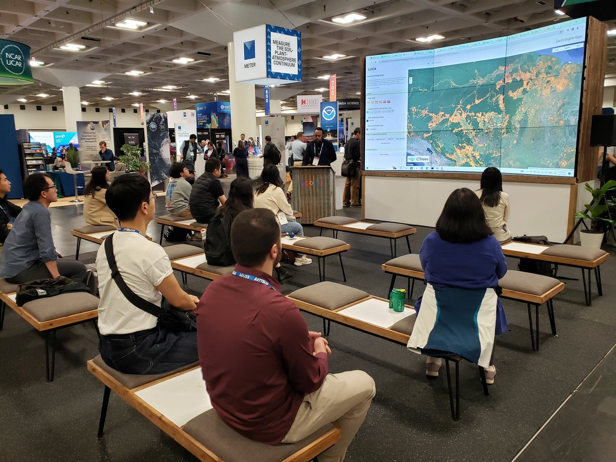
My colleague Adugna G. Mullissa is showcasing #LUCA the forest alert system from CTrees at the Google booth in #AGU23 right now. Come and have a chat if you are around :)

My colleague <a href="/DrAdugna/">Adugna G. Mullissa</a> is showcasing #LUCA the forest alert system from <a href="/CTrees_org/">CTrees</a> at the Google booth in #AGU23 right now. Come and have a chat if you are around :)
Justin Braaten (@jstnbraaten) 's Twitter Profile Photo

.Adugna G. Mullissa gives a tour of the CTrees's Land Use Change Alerts (LUCA) data at #AGU23. Learn about the dataset and explore it in an #EarthEngine app 👇 ctrees.org/products/luca

.<a href="/DrAdugna/">Adugna G. Mullissa</a> gives a tour of the <a href="/CTrees_org/">CTrees</a>'s Land Use Change Alerts (LUCA) data at #AGU23. Learn about the dataset and explore it in an #EarthEngine app 👇
ctrees.org/products/luca
Red List of Ecosystems (@redlisteco) 's Twitter Profile Photo

#GreenhouseGas emissions from tropical forest loss increased by 5% in 2022 from the year before, while temperate forests bolstered their carbon-absorbing capacity, according to CTrees Read the full news 👇 buff.ly/3v8hJxj Via Mongabay

#GreenhouseGas emissions from tropical forest loss increased by 5% in 2022 from the year before, while temperate forests bolstered their carbon-absorbing capacity, according to <a href="/CTrees_org/">CTrees</a>

Read the full news 👇 
buff.ly/3v8hJxj
Via <a href="/MongabayOrg/">Mongabay</a>
Fabien Wagner (@fabienwagner) 's Twitter Profile Photo

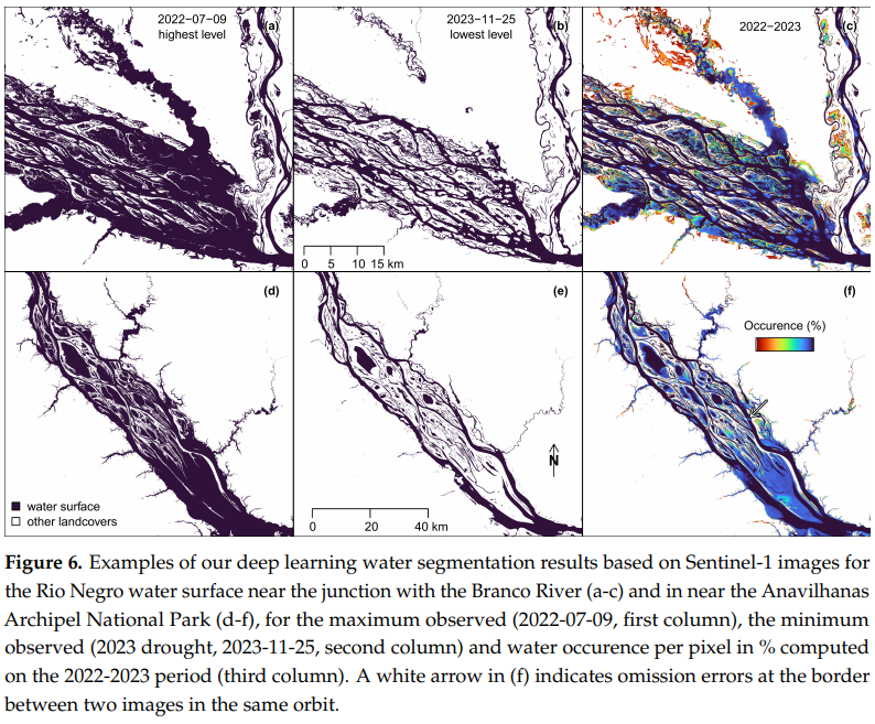
🌍 Amazon's historic 2023 drought: Rio Negro River, one on the largest river of the Amazon, hits century-low by Oct/Nov😱Sentinel-1 SAR data & AI 🤖 reveal water surface decrease to 9,559.9 km², 68.1% of max. surface observed in 2022-23 🛰️🤖💧CTrees arxiv.org/abs/2401.16393

🌍 Amazon's historic 2023 drought: Rio Negro River, one on the largest river of the Amazon, hits century-low by Oct/Nov😱Sentinel-1 SAR data &amp; AI 🤖 reveal water surface decrease to 9,559.9 km², 68.1% of max. surface observed in 2022-23 🛰️🤖💧<a href="/CTrees_org/">CTrees</a> arxiv.org/abs/2401.16393
Ricardo Dalagnol (@ricardodalagnol) 's Twitter Profile Photo

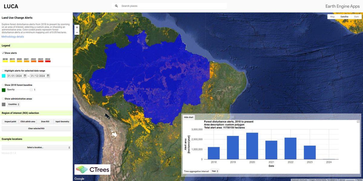
🛰️🌳🪵🔥Number of land use alerts in the Brazilian #Amazon in 2023 dropped to pre-2019 lvls. Still a lot of work to do for #ZeroDeforestation - letsgo! 📎 Data #LUCA @ bit.ly/ctrees-luca -CTrees PS: This feature to input your own GeoJSON ("new age shapefile") rocks.🚀

🛰️🌳🪵🔥Number of land use alerts in the Brazilian #Amazon in 2023 dropped to pre-2019 lvls. Still a lot of work to do for #ZeroDeforestation - letsgo!

📎 Data #LUCA @ bit.ly/ctrees-luca -<a href="/CTrees_org/">CTrees</a>

PS: This feature to input your own GeoJSON ("new age shapefile") rocks.🚀
Fabien Wagner (@fabienwagner) 's Twitter Profile Photo

Our new published research on the Amazon’s 2023 Drought highlights our method for near real-time large scale mapping of water surfaces every 12 days using Deep Learning and Sentinel-1 SAR. mdpi.com/2716430 #amazonforest #drought CTrees

Our new published research on the Amazon’s 2023 Drought highlights our method for near real-time large scale mapping of water surfaces every 12 days using Deep Learning and Sentinel-1 SAR. mdpi.com/2716430
#amazonforest #drought <a href="/CTrees_org/">CTrees</a>
CTrees (@ctrees_org) 's Twitter Profile Photo

RELEASE: CTrees scientists led by Fabien Wagner have mapped the height of all trees in California by applying a deep learning model to very high resolution aerial imagery. The result is the most accurate map of the state's canopy height to date 🌐🌲ctrees.org/news/californi…
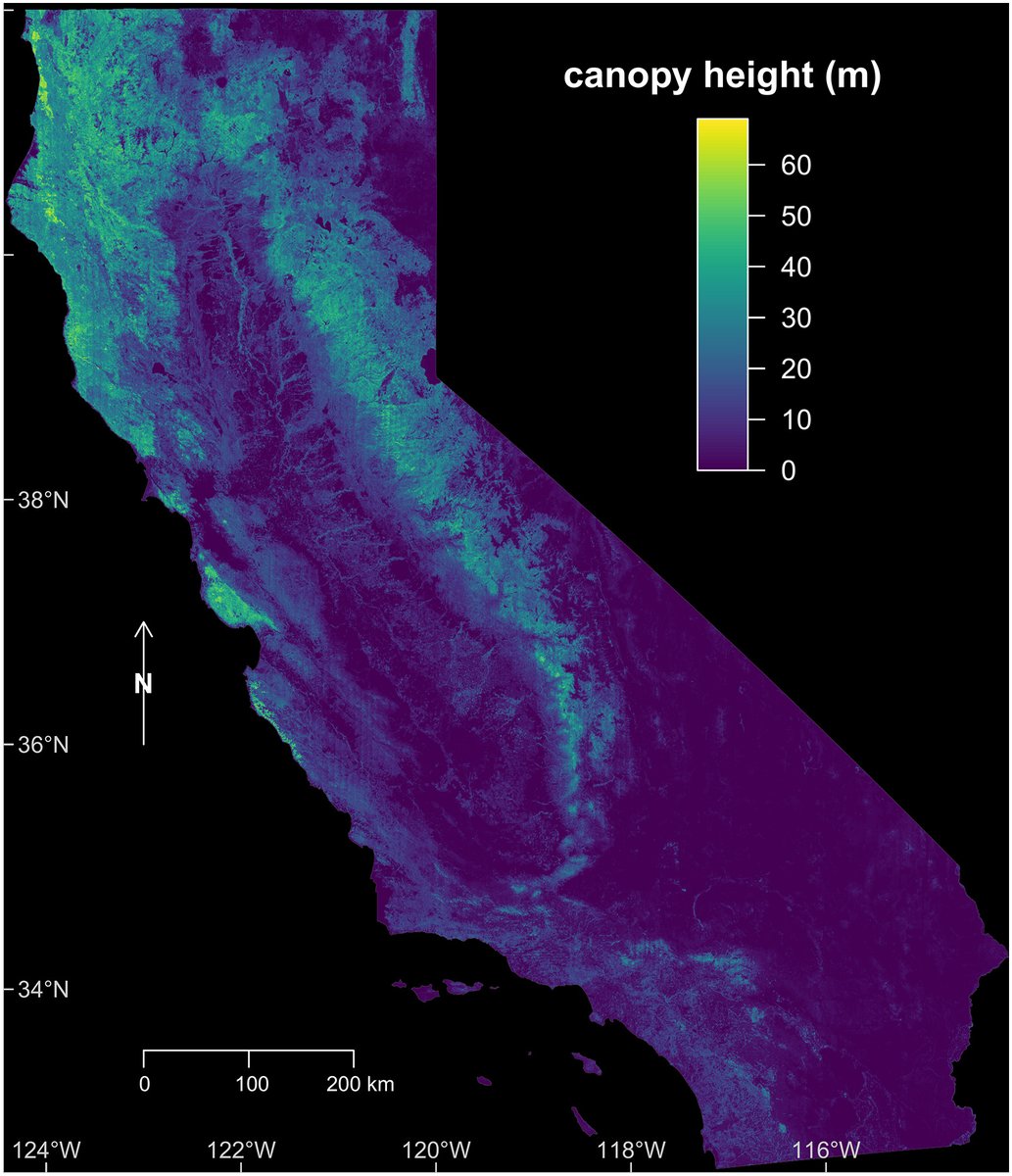
RELEASE: CTrees scientists led by <a href="/FabienWagner/">Fabien Wagner</a>  have mapped the height of all trees in California by applying a deep learning model to very high resolution aerial imagery. 

The result is the most accurate map of the state's canopy height to date 🌐🌲ctrees.org/news/californi…
Ricardo Dalagnol (@ricardodalagnol) 's Twitter Profile Photo

📢🌳New paper led by Fabien Wagner in RSE on tree's height mapping over California with #DeepLearning I really like Fig 7 : it clearly shows how the model predicts height based on optical imagery very close to LiDAR even on STEEP terrain - crazy! 😮 doi.org/10.1016/j.rse.…
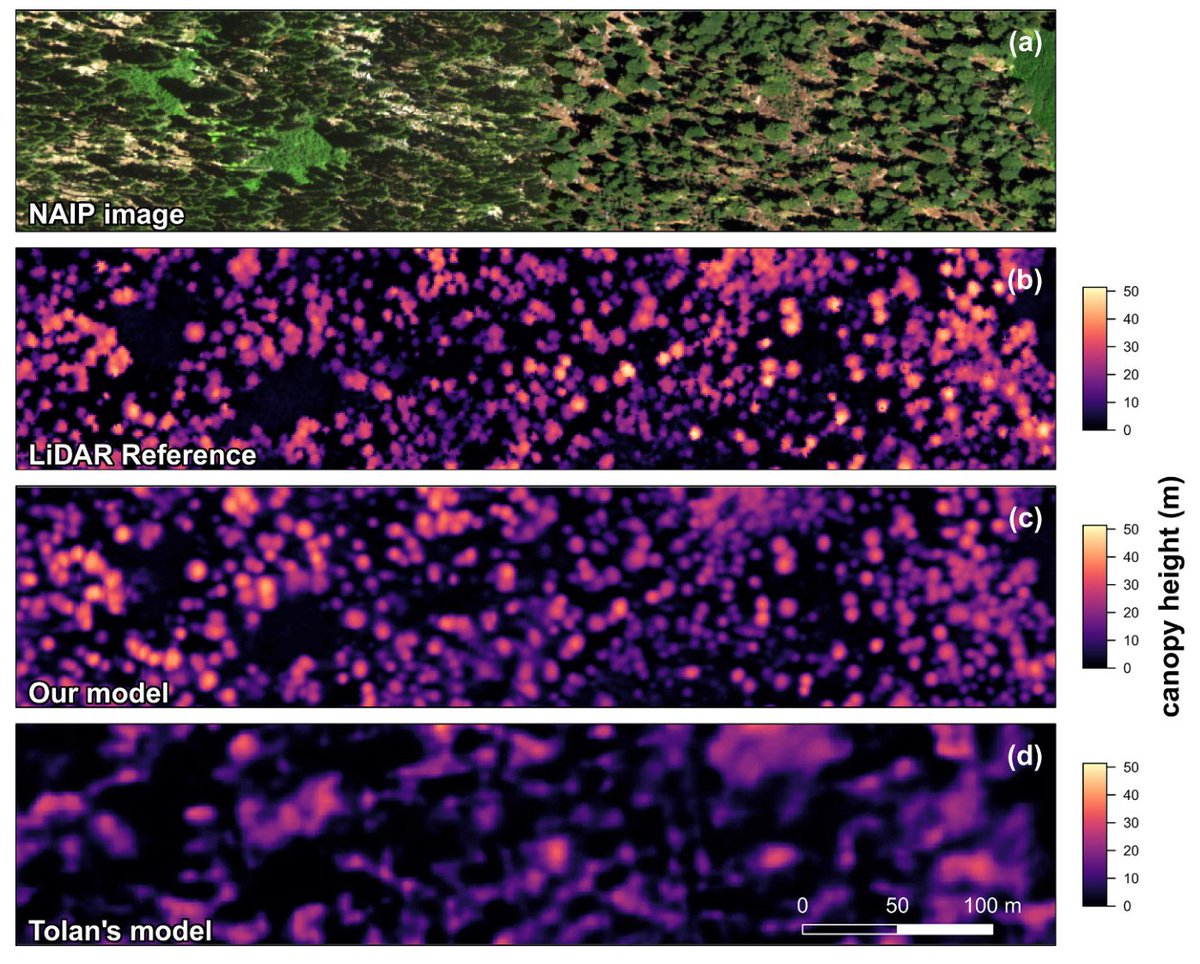
📢🌳New paper led by <a href="/FabienWagner/">Fabien Wagner</a> in RSE on tree's height mapping over California with #DeepLearning 

I really like Fig 7 : it clearly shows how the model predicts height based on optical imagery very close to LiDAR even on STEEP terrain - crazy! 😮

doi.org/10.1016/j.rse.…
eebiomass (@eebiomass) 's Twitter Profile Photo

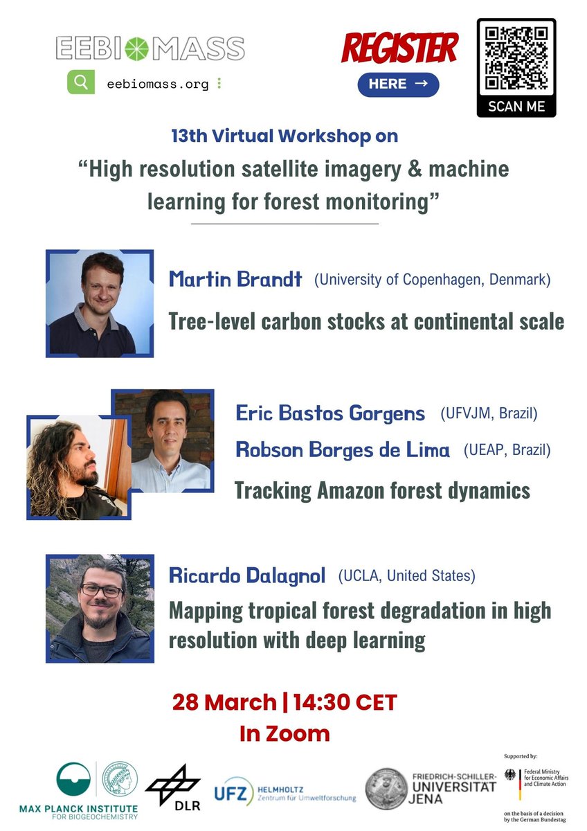
🌿 Join our 13th EEBIOMASS #workshop on “High-resolution satellite imagery & #MachineLearning for #forest monitoring” on MAR 28, 14:30 - 16:30 CET. 👥 Meet our speakers: Martin Brandt, Eric Gorgens, Robson Lima, Ricardo Dalagnol 📢 Register here: survey.academiccloud.de/index.php/1764…

🌿 Join our 13th EEBIOMASS #workshop on “High-resolution satellite imagery &amp; #MachineLearning for #forest monitoring” on MAR 28, 14:30 - 16:30 CET.

👥 Meet our speakers: Martin Brandt, Eric Gorgens, Robson Lima, Ricardo  Dalagnol

📢 Register here: survey.academiccloud.de/index.php/1764…
CTrees (@ctrees_org) 's Twitter Profile Photo

CTrees research scientist Ricardo Dalagnol will speak at a workshop on hi-res satellite imagery and machine learning for forest monitoring TOMORROW, March 28 at 14:30 CET -->

CTrees (@ctrees_org) 's Twitter Profile Photo

NEWS: Alkad Mzu is pleased to announce the appointment of Stephen Hagen, Ph.D., as its first chief operating officer. As COO, Hagen will manage CTrees’ data and research initiatives for monitoring, reporting, and verification of natural climate solutions ctrees.org/news/stephen-h…

Martin Brandt (@matin_brandt) 's Twitter Profile Photo

We mapped a half billion individual farmland trees in India, and tracked their fate over a decade. Many large trees have disappeared. The paper in Nature Sus.: doi.org/10.1038/s41893…, Viewer: rs-cph.projects.earthengine.app/view/tree. It's a new framework for temporal monitoring of single trees..

Ricardo Dalagnol (@ricardodalagnol) 's Twitter Profile Photo

📢🌲Sharing our new paper led by Griffin Carter Griffin Carter : "Detection of forest disturbance across California using deep-learning on PlanetScope imagery" 🔍Creek Fire in 2020 w/ CALFIRE map (red) and our 3x3 m detection (yellow) 📎 doi.org/10.3389/frsen.… UCLA Environment CTrees
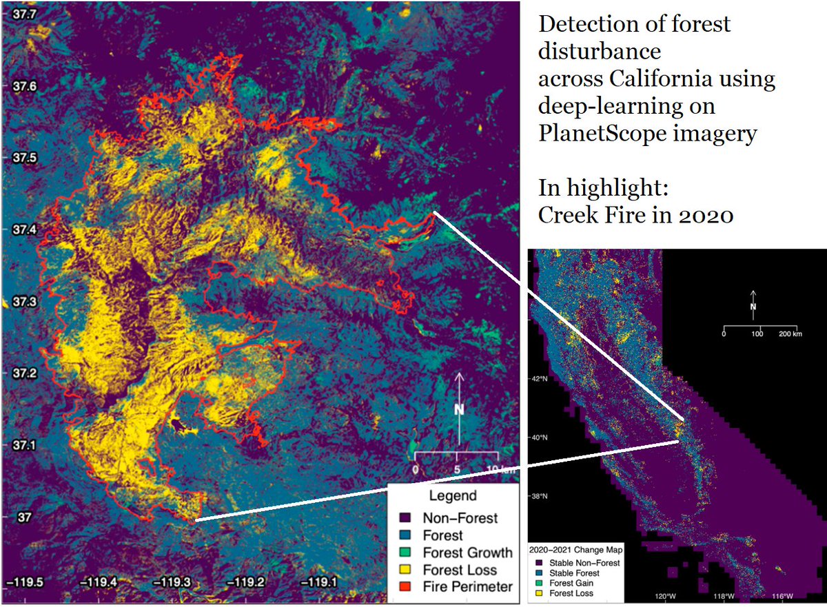
📢🌲Sharing our new paper led by Griffin Carter <a href="/gc_sci/">Griffin Carter</a> : "Detection of forest disturbance across California using deep-learning on PlanetScope imagery"

🔍Creek Fire in 2020 w/ CALFIRE map (red) and our 3x3 m detection (yellow)

📎 doi.org/10.3389/frsen.…

<a href="/UCLAIoES/">UCLA Environment</a> <a href="/CTrees_org/">CTrees</a>
CTrees (@ctrees_org) 's Twitter Profile Photo

RESEARCH: CTrees' Griffin Carter worked with Fabien Wagner and Ricardo Dalagnol, postdoctoral researchers at UCLA Environment and research scientists at CTrees, on innovative approaches to map tree cover in California. Study now published in Frontiers in Remote Sensing ⤵️

Ricardo Dalagnol (@ricardodalagnol) 's Twitter Profile Photo

📢🛰️New paper from Le Bien brings the most accurate #Carbon map of #Gabon to date based on #GEDI & #MachineLearning, verified using #ALS & National Plot Inventory, and shows its variability in the landscape and in forest management doi.org/10.1088/1748-9… UCLA Environment CTrees

📢🛰️New paper from Le Bien brings the most accurate #Carbon map of #Gabon to date based on #GEDI &amp; #MachineLearning, verified using #ALS &amp; National Plot Inventory, and shows its variability in the landscape and in forest management

doi.org/10.1088/1748-9…

<a href="/UCLAIoES/">UCLA Environment</a> <a href="/CTrees_org/">CTrees</a>
Climate TRACE (@climatetrace) 's Twitter Profile Photo

In 2020, 4 billion tons of live #carbon were stored in Gabon’s forests, according to new research from CTrees. Learn more about their findings from measuring the live carbon density of every hectare of forest in Gabon. ctrees.org/news/gabon-car…

Ricardo Dalagnol (@ricardodalagnol) 's Twitter Profile Photo

Visited INPE this week and presented some updates on the research I lead at CTrees. Top level discussions on forest degradation and applied AI for earth observation. Thanks Luiz Aragao TREES-Research Lab DSR INPE for the invite ! :)
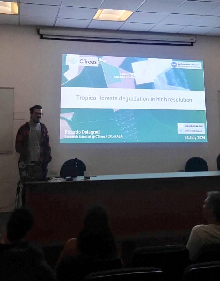
Visited INPE this week and presented some updates on the research I lead at <a href="/CTrees_org/">CTrees</a>. Top level discussions on forest degradation and applied AI for earth observation. Thanks <a href="/aragao_luiz/">Luiz Aragao</a> <a href="/TREES_Research/">TREES-Research Lab</a> <a href="/dsrinpe/">DSR INPE</a> for the invite ! :)
Fabien Wagner (@fabienwagner) 's Twitter Profile Photo

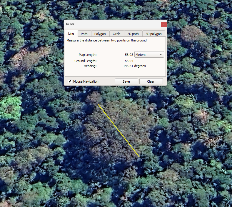
Just discovered the most massive tree I've ever seen in the Amazon rainforest via satellite image—over 50 meters in crown diameter and more than 50 meters in height! 🛰🌳CTrees Ricardo Dalagnol

Just discovered the most massive tree I've ever seen in the Amazon rainforest via satellite image—over 50 meters in crown diameter and more than 50 meters in height! 🛰🌳<a href="/CTrees_org/">CTrees</a> <a href="/RicardoDalagnol/">Ricardo Dalagnol</a>