Dr. Eric J Fielding, PhD (@ericfielding) 's Twitter Profile
Dr. Eric J Fielding, PhD

@ericfielding

Geophysicist at lab in Pasadena, California. Statements and opinions posted by me are my own and not my employer. he/him. Also at @[email protected]

ID: 106753392

linkhttps://science.jpl.nasa.gov/people/Fielding/ calendar_today20-01-2010 15:54:36

26,26K Tweet

10,10K Followers

2,2K Following

Franz J Meyer (@sarevangelist) 's Twitter Profile Photo

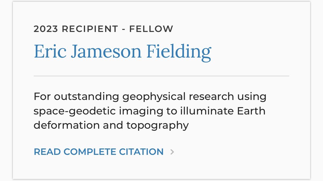
🚨#SAR Twitter🚨 One more fantastic news for all y’all. Our colleague and friend NASA JPL Eric Fielding (Dr. Eric J Fielding, PhD) became AGU’s Fellow. Congratulations Eric and thanks for all you do for the community! Excellent choices AGU (American Geophysical Union) ! 🥳 #GoldenAgeOfSAR
🚨#SAR Twitter🚨
One more fantastic news for all y’all. Our colleague and friend <a href="/NASAJPL/">NASA JPL</a> Eric Fielding (<a href="/EricFielding/">Dr. Eric J Fielding, PhD</a>) became AGU’s Fellow. Congratulations Eric and thanks for all you do for the community!

Excellent choices <a href="/theAGU/">AGU (American Geophysical Union)</a> ! 🥳
#GoldenAgeOfSAR
Jasmin Moghbeli (@astrojaws) 's Twitter Profile Photo

Prior to leaving on my first military deployment, my good friend and I set out on a trip to New Zealand. It wasn’t a very long trip so we chose to explore only the North Island, both by car and by foot. I learned that when a Kiwi says a hike is of moderate difficulty, it means

Prior to leaving on my first military deployment, my good friend and I set out on a trip to New Zealand. It wasn’t a very long trip so we chose to explore only the North Island, both by car and by foot. I learned that when a Kiwi says a hike is of moderate difficulty, it means
Sérgio OSMsmaprs (@sergioajv1) 's Twitter Profile Photo

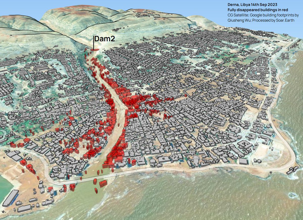
🇱🇾#Derna, #Libya #Floods Updates on Soar Atlas : -3D view assesment of fully disappeared buildings (red) -Cloudless CG Satellite 14th Sep 2023 soar.earth/maps/15807 🙏Google building footprints by Qiusheng Wu Qiusheng Wu : x.com/giswqs/status/…

🇱🇾#Derna, #Libya #Floods 
Updates on <a href="/Soar_Earth/">Soar</a> Atlas :
-3D view assesment of fully disappeared buildings (red)
-Cloudless CG Satellite 14th Sep 2023
soar.earth/maps/15807

🙏Google building footprints by Qiusheng Wu <a href="/giswqs/">Qiusheng Wu</a> :  x.com/giswqs/status/…
USGS ShakeAlert (@usgs_shakealert) 's Twitter Profile Photo

Good evening Northern CA. Did you feel the magnitude 4.4 earthquake about 9 miles southwest of Westley 9:13 pm? The #ShakeAlert system was activated. See: earthquake.usgs.gov/earthquakes/ev… California Governor's Office of Emergency Services Listos California California Geological Survey
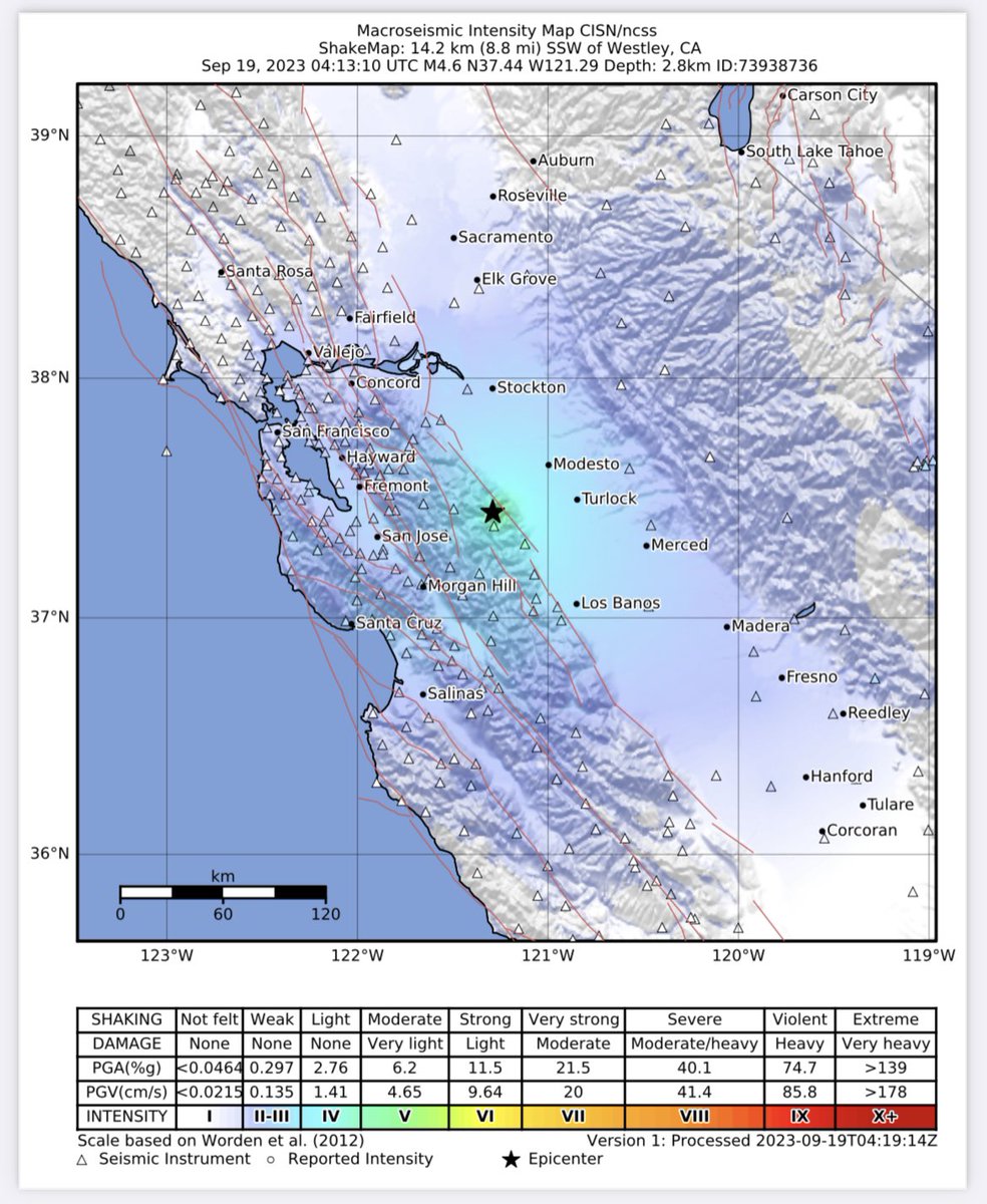
Good evening Northern CA. Did you feel the magnitude 4.4
earthquake about 9 miles southwest of  Westley 9:13 pm? The #ShakeAlert system was activated. See: earthquake.usgs.gov/earthquakes/ev… <a href="/Cal_OES/">California Governor's Office of Emergency Services</a> <a href="/ListosCA/">Listos California</a> <a href="/CAGeoSurvey/">California Geological Survey</a>
Manoochehr Shirzaei (@shirzaei) 's Twitter Profile Photo

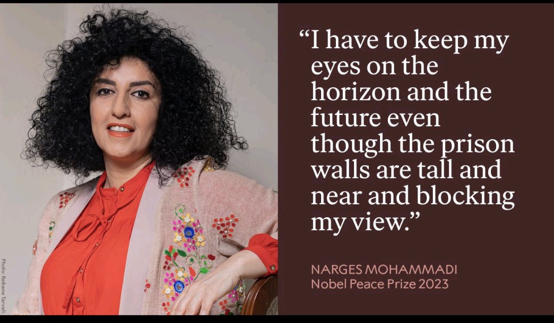
Congratulations to dear #NargesMohammadi for peace #NobelPrize. We all are so proud of you and thank you for all you do for the people of #Iran, particularly #WomenRights nobelprize.org/prizes/peace/2…

Congratulations to dear #NargesMohammadi for peace #NobelPrize.
We all are so proud of you and thank you for all you do for the people of #Iran, particularly #WomenRights

nobelprize.org/prizes/peace/2…
Zakeria Shnizai (@shnizaii) 's Twitter Profile Photo

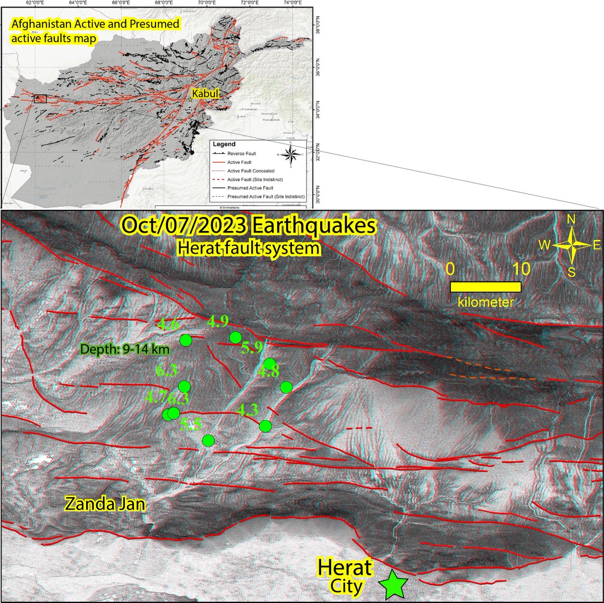
The 9 earthquakes that occurred in Herat, Afghanistan today occurred exactly where the Herat active fault system is located. Check out the active faults map below which I prepared in 2020 using SRTM DEM 1-arcsecond anaglyph images interpretation. The EQs location is from USGS..

The 9 earthquakes that occurred in Herat, Afghanistan today occurred exactly where the Herat active fault system is located. Check out the active faults map below which I prepared in 2020 using SRTM DEM 1-arcsecond anaglyph images interpretation. The EQs location is from USGS..
Zakeria Shnizai (@shnizaii) 's Twitter Profile Photo

After analyzing the anaglyph, I found that there is an offset of approximately 5.5 km along the southern region of the Hari Rud River. link.springer.com/content/pdf/10…

Zakeria Shnizai (@shnizaii) 's Twitter Profile Photo

Approximately, the casualty toll has risen to 2,500 people due to yesterday's EQs in Herat Afghanistan. What makes the population so vulnerable? In this regard, last year together with Richard Walker, Sotiris Valkaniotis and Morteza Talebian, we wrote an article for temblor.

Approximately, the casualty toll has risen to 2,500 people due to yesterday's EQs in  Herat Afghanistan. What makes the population so vulnerable? In this regard, last year together with <a href="/RichardThomasW/">Richard Walker</a>, <a href="/SotisValkan/">Sotiris Valkaniotis</a> and Morteza Talebian, we wrote an article for <a href="/temblor/">temblor</a>.
Irfan Rashid (@irfansalroo) 's Twitter Profile Photo

First high-resolution pre and post #GLOF images of the complete destruction of #Chungthang dam (#Teesta3HEP) caused due to rapid drainage of #SouthLhonakLake, #Sikkim via Planet Labs

Zakeria Shnizai (@shnizaii) 's Twitter Profile Photo

The situation in Herat and the surrounding region has worsened due to the cold and snowy winter, that was being hit by tens of EQs. >2000 houses in 20 villages have been destroyed, leaving many homeless. To add to the problem, there is a bad wind causing dunes to appear everywhre

Sérgio OSMsmaprs (@sergioajv1) 's Twitter Profile Photo

🔥Severe #drought in #Amazonia #Brazil 🇧🇷: 🔴Red is dry land where there was river 🛰️#SAR Radar Satellite Mosaic on Soar : soar.earth/maps/16007 Sentinel-1 October x June from European Space Agency Copernicus EU Sentinel Hub #Education #ClimateAction

🔥Severe #drought in #Amazonia #Brazil 🇧🇷:
🔴Red is dry land where there was river
🛰️#SAR Radar Satellite Mosaic on <a href="/Soar_Earth/">Soar</a> :
soar.earth/maps/16007
Sentinel-1 October x June from 
<a href="/esa/">European Space Agency</a> <a href="/CopernicusEU/">Copernicus EU</a> <a href="/sentinel_hub/">Sentinel Hub</a>
#Education #ClimateAction
Dan Shugar (@watershedlab) 's Twitter Profile Photo

A glacial lake outburst flood has occurred in Bhutan @ Thorthormi glacial lake, visible in this pre-event Planet image. No post-event imagery of the lake yet, but a small sliver of the Pho Chu river, about 80km downstream shows dramatically elevated turbidity. Stuart Dunning

A glacial lake outburst flood has occurred in Bhutan @ Thorthormi glacial lake, visible in this pre-event <a href="/planet/">Planet</a> image. No post-event imagery of the lake yet, but a small sliver of the Pho Chu river, about 80km downstream shows dramatically elevated turbidity. <a href="/Rock_Avalanches/">Stuart Dunning</a>
NASA (@nasa) 's Twitter Profile Photo

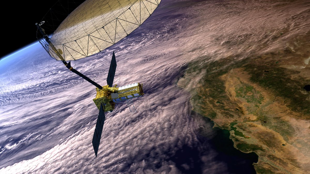
We’ve teamed up with @ISRO on the NISAR mission, a satellite that will measure changes on Earth’s surface in fine detail. Data from NISAR can help us better manage natural resources, and understand the pace and effects of climate change. nisar.jpl.nasa.gov

AGU's Eos (@agu_eos) 's Twitter Profile Photo

The Caspian Sea is receding rapidly. Satellite data are helping scientists understand how the coastline will change. eos.org/articles/as-th…

Sérgio OSMsmaprs (@sergioajv1) 's Twitter Profile Photo

#Floods🔴#Enchente em #PortoAlegre 2024 MAPA COMPLETO: Cota Máxima ~5m Composição de Satélites: 06, 09 e 14 de Maio Em Soar - The New Atlas🌐: ➡️soar.earth/maps/18864 🛰️Courtesy: Planet - Crisis Response Program #ClimateCrisis #ClimateEmergency

#Floods🔴#Enchente em #PortoAlegre 2024  
MAPA COMPLETO: Cota Máxima ~5m
Composição de Satélites: 06, 09 e 14 de Maio

Em <a href="/Soar_Earth/">Soar</a> - The New Atlas🌐:
➡️soar.earth/maps/18864

🛰️Courtesy: <a href="/planet/">Planet</a> - Crisis Response Program
#ClimateCrisis #ClimateEmergency
NASAEarthdata (@nasaearthdata) 's Twitter Profile Photo

New tutorials at NASA's #ASFDAAC demonstrate how to visualize, analyze, and transform #NISAR sample data products. Find tutorials for a #GIS environment (ArcGIS Pro, QGIS), data exploration with Panoply, and data transformation using #GDAL commands. #SAR go.nasa.gov/4aFJgWd

New tutorials at NASA's #ASFDAAC demonstrate how to visualize, analyze, and transform #NISAR sample data products. Find tutorials for a #GIS environment (ArcGIS Pro, QGIS), data exploration with Panoply, and data transformation using #GDAL commands. #SAR
go.nasa.gov/4aFJgWd
Alexander Handwerger (@thehandwerger) 's Twitter Profile Photo

OPERA will host a free hybrid (online + in person) workshop on Friday, July 19, 2024, from 8:30 am – 1:05 pm Pacific Time at the Liberty Station Conference Center, San Diego, CA. To register please see our website jpl.nasa.gov/go/opera/opera…. We hope to see you there!