Jamon Van Den Hoek (@jamonvdh) 's Twitter Profile
Jamon Van Den Hoek

@jamonvdh

Conflict Ecology • Monitoring armed conflict, refugee landscapes, and long-term enviro change from space • Assoc Prof of Geography at Oregon State

ID: 14564868

linkhttps://conflict-ecology.org calendar_today28-04-2008 03:14:55

1,1K Tweet

2,2K Followers

1,1K Following

NASAARSET 🛰🌎 (@nasaarset) 's Twitter Profile Photo

This training series will present strategies for using Earth observations to map and assess flood risk, drought affects on agriculture, and heat stress in refugee and IDP (Internally Displaced People) settings around the world. Registration now open: go.nasa.gov/3wfv6g9

This training series will present strategies for using Earth observations to map and assess flood risk, drought affects on agriculture, and heat stress in refugee and IDP (Internally Displaced People) settings around the world. 

Registration now open: go.nasa.gov/3wfv6g9
Jamon Van Den Hoek (@jamonvdh) 's Twitter Profile Photo

Between 4 May 03:44:32 UTC and 8 May 15:49:05 UTC, we mapped 895 buildings in Rafah that were likely damaged or destroyed. This brings the total number of likely damaged/destroyed buildings in Rafah to 17,689 of 48,678 (36.3%). corey scher
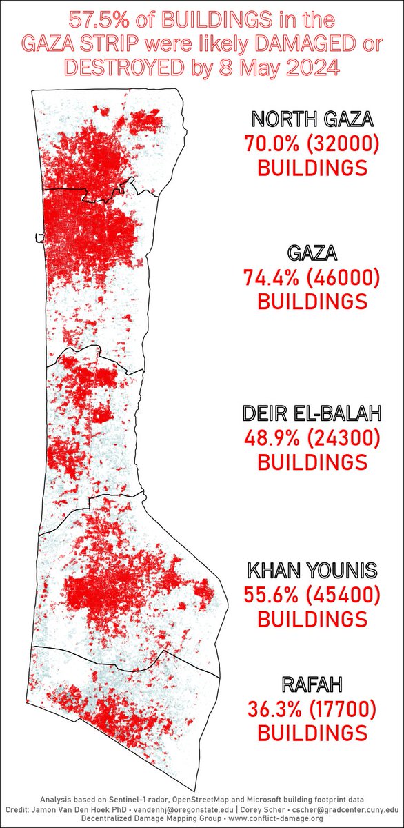
Between 4 May 03:44:32 UTC and 8 May 15:49:05 UTC, we mapped 895 buildings in Rafah that were likely damaged or destroyed. This brings the total number of likely damaged/destroyed buildings in Rafah to 17,689 of 48,678 (36.3%). <a href="/coreymaps/">corey scher</a>
Dr. Laura E. R. Peters ☮️ (@lauraerpeters) 's Twitter Profile Photo

Call for papers📢for a special collection in Sustainability: Science, Practice and Policy Taylor & Francis Research Insights! We seek manuscripts exploring the potential to forge new paths to #sustainability in #conflict contexts through #DisasterDiplomacy & #EnvironmentalPeacebuilding.

Call for papers📢for a special collection in Sustainability: Science, Practice and Policy <a href="/tandfonline/">Taylor & Francis Research Insights</a>!  We seek manuscripts exploring the potential to forge new paths to #sustainability in #conflict contexts through #DisasterDiplomacy &amp; #EnvironmentalPeacebuilding.
Jamon Van Den Hoek (@jamonvdh) 's Twitter Profile Photo

Between 16-20 May 2024, we estimate 550 buildings in Rafah were likely damaged/destroyed. This translates to 38.5% of buildings in Rafah being likely damaged/destroyed and 58.0% across Gaza. corey scher

Between 16-20 May 2024, we estimate 550 buildings in Rafah were likely damaged/destroyed. This translates to 38.5% of buildings in Rafah being likely damaged/destroyed and 58.0% across Gaza. <a href="/coreymaps/">corey scher</a>
NASAARSET 🛰🌎 (@nasaarset) 's Twitter Profile Photo

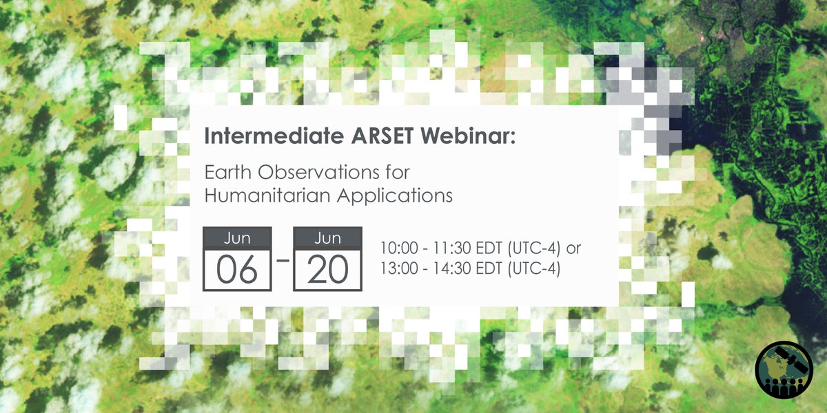
This training series will focus on flood risk, gauging long-term #HeatStress & the challenges with decision making surrounding heat risk, and monitoring drought effects on agricultural landscapes in refugee and internally displaced person (IDP) settings: go.nasa.gov/3wfv6g9

This training series will focus on flood risk, gauging long-term #HeatStress &amp; the challenges with decision making surrounding heat risk, and monitoring drought effects on agricultural landscapes in refugee and internally displaced person (IDP) settings: go.nasa.gov/3wfv6g9
Cate Brown (@catebrown12) 's Twitter Profile Photo

Incredible deep dive on the destruction of #Ukraine - with beautiful images of Marinka - by Marco Hernandez, with corey scher and Jamon Van Den Hoek always powering good work. nytimes.com/interactive/20…
corey scher (@coreymaps) 's Twitter Profile Photo

A nationwide survey of damage to buildings in Ukraine is a big part of my dissertation research. Jamon Van Den Hoek and I worked with the talented Marco Hernandez and Tim Wallace to support their team The New York Times reporting on damage with our data. Their piece is out today: nytimes.com/interactive/20…

Marco Hernandez (@tmarcoh) 's Twitter Profile Photo

What Ukraine has lost during Russia's invasion. The print version just came out today. I just published a technical note to my blog if you want to learn more about this project: bit.ly/3RESnzJ

Alexander Prishchepov (@prial78) 's Twitter Profile Photo

Two-year postdoc in Geoinformatics and High-Resolution Satellite Remote Sensing focusing on urban expansion and conversion of natural areas around African cities. University of Copenhagen.Deadline: 4 September 2024 employment.ku.dk/faculty/?show=…

Jamon Van Den Hoek (@jamonvdh) 's Twitter Profile Photo

As of 3 July 2024, nearly 44% of buildings in Rafah and 59% of all buildings in the Gaza Strip have likely been damaged/destroyed since 5 Oct 2023. This is our 33rd map of likely damage/destruction across Gaza. corey scher

As of 3 July 2024, nearly 44% of buildings in Rafah and 59% of all buildings in the Gaza Strip have likely been damaged/destroyed since 5 Oct 2023. This is our 33rd map of likely damage/destruction across Gaza.

<a href="/coreymaps/">corey scher</a>
Jamon Van Den Hoek (@jamonvdh) 's Twitter Profile Photo

Calling all researchers working at the intersection of armed conflict and environmental change --> We're organizing a session at the AGU Fall meeting - please submit your work! agu.confex.com/agu/agu24/prel… w/ corey scher Emnet Negash Iryna Dronova

Calling all researchers working at the intersection of armed conflict and environmental change --&gt; We're organizing a session at the AGU Fall meeting - please submit your work! agu.confex.com/agu/agu24/prel… w/ <a href="/coreymaps/">corey scher</a> <a href="/emnet_negash/">Emnet Negash</a> <a href="/IrynaDronova/">Iryna Dronova</a>
Tillmann von Carnap (@tcarnap) 's Twitter Profile Photo

We've posted a new version of our working paper "Using satellite imagery to monitor remote rural economies at high frequency". We track economic activity by measuring attendance in open-air marketplaces with near-daily imagery. Three key takeaways: arxiv.org/pdf/2407.12953

We've posted a new version of our working paper "Using satellite imagery to monitor remote rural economies at high frequency". 

We track economic activity by measuring attendance in open-air marketplaces with near-daily imagery. 

Three key takeaways:
 arxiv.org/pdf/2407.12953
Wim Zwijnenburg (@wammezz) 's Twitter Profile Photo

The ongoing bombings on the borders between Israel and Lebanon resulting already in severe destruction of houses, displacement and affected agricultural areas, new #remotesensing analysis by corey scher / Jamon Van Den Hoek He YIN | 殷贺 shows. Good BBC piece below bbc.com/news/articles/…

The ongoing bombings on the borders between Israel and Lebanon resulting already in severe destruction of houses, displacement and affected agricultural areas, new #remotesensing analysis by <a href="/coreymaps/">corey scher</a> / <a href="/JamonVDH/">Jamon Van Den Hoek</a>  <a href="/hyinhe/">He YIN | 殷贺</a>  shows.  Good <a href="/BBC/">BBC</a> piece below

bbc.com/news/articles/…
Jamon Van Den Hoek (@jamonvdh) 's Twitter Profile Photo

📅Abstracts are due in 1 week (31 July 2024) for our AGU session, "Tracking the Footprint of War: Earth and Environmental Science Perspectives on Monitoring Conflict Impacts"👇Feel free to reach out with any questions!

Christopher Ingraham🦗 (@_cingraham) 's Twitter Profile Photo

Here's a wild anecdote: while teaching high school students about genocide in 1993, Walz had them use GIS data to predict where the next one would occur. They said Rwanda. (the NYT verified this via interviews with some of those students in a 2008 story)

Here's a wild anecdote: while teaching high school students about genocide in 1993, Walz had them use GIS data to predict where the next one would occur. They said Rwanda. (the NYT verified this via interviews with some of those students in a 2008 story)