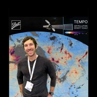
Aaron Naeger
@naegeraaron
Research scientist @NASA_Marshall @NASA_SPoRT. Mission Applications Lead @TEMPO_Mission. Air quality+weather+satellite+travel+fitness enthusiast. Tweets my own.
ID: 1302355751600496642
05-09-2020 21:19:49
1,1K Tweet
541 Followers
357 Following
 's Twitter Profile Photo")
 on Twitter photo Our team attended the Mission Applications Early Adopter Showcase in D.C.! 🌍 Presenters highlighted how <a href=\"/NASA/\">NASA</a> data, including TEMPO, TROPICS, and the SPoRT Sea Surface Temperature Composite, enhances air quality and hurricane forecasting for informed Earth action!")
 's Twitter Profile Photo")
 (@pallavipnt) 's Twitter Profile Photo")
 's Twitter Profile Photo")
Debby made landfall in Florida as a Category 1 hurricane with 80 mph winds and is now downgraded to a tropical storm. With flooding expected, SPoRT tools can help decision-makers assess risks: LIS: weather.ndc.nasa.gov/sport/viewer/?… & Streamflow-AI: weather.ndc.nasa.gov/sport/viewer/?…
 's Twitter Profile Photo")
Groundbreaking #TEMPO sensor observed hourly evolution of nitrogen dioxide (NO2) plumes from #ParkFire in California & several #wildfires in Oregon & Washington State on 5 Aug. TEMPO Mission Aaron Naeger Dan Goldberg, PhD Joel Dreessen
 's Twitter Profile Photo")
#GOESEast #ABI aerosol optical depth (AOD) shows #smoke (AOD ≥0.5) from Canadian #wildfires moving into Northeast US this morning 14 Aug. Smoke aloft currently, but MD Environment expects mixing to surface later today causing Code Yellow daily PM2.5 #AirQuality. NOAA Satellites
 on Twitter photo 🔥 Discover NASA SPoRT's research on the role of lightning in wildfires! Their two-decade study of 50,000 wildfires reveals the impact of weaker strikes and \"holdovers\"—fires that flare up days after the initial strike. Learn more: go.nasa.gov/3WLt2Gc ⚡")
 on Twitter photo Catch up on your summer reading with HAQAST publications! This study on the public health effects from the unparalleled 2022 New Mexico wildfires underscores the impact of the fires on air quality and human health as global warming intensifies.
buff.ly/3WVpXV6")
 on Twitter photo Interested in the public health impacts of prescribed fire smoke? Read how HAQAST members and other researchers found that PM2.5 concentrations substantially increased on days impacted by smoke from fires in eastern Kansas compared to days without smoke.
buff.ly/3yGVX5Y")
 's Twitter Profile Photo")
 on Twitter photo NASA and <a href=\"/NOAA/\">NOAA</a> have agreed to use <a href=\"/NASA/\">NASA</a>'s Common Metadata Repository (CMR) to catalog, search, and discover data. Learn more about how this will enhance your ability to find and use data: go.nasa.gov/3YBDHFM")
The “corridor” of thick #smoke (dark red shading) from record-breaking #wildfires in the #AmazonBasin continues to be trapped east of the #AndesMountains in #Peru, #Brazil & #Bolivia today 23 Aug, shown by #GOESEast #ABI aerosol optical depth (AOD). NOAA MetSul #AjudaRS Vitor Tavares
 on Twitter photo The “corridor” of thick #smoke (dark red shading) from record-breaking #wildfires in the #AmazonBasin continues to be trapped east of the #AndesMountains in #Peru, #Brazil & #Bolivia today 23 Aug, shown by #GOESEast #ABI aerosol optical depth (AOD). <a href=\"/NOAA/\">NOAA</a> <a href=\"/metsul/\">MetSul #AjudaRS</a> <a href=\"/vitoramtav/\">Vitor Tavares</a>")
Observations from historic #TEMPO sensor reveal buildup of nitrogen dioxide (NO2) (yellow/orange/red shading) in urban centers on 27 Aug, contributing to #AirQualityAlert days in several major cities in eastern half of US. TEMPO Mission Aaron Naeger Joel Dreessen Dan Goldberg, PhD
 's Twitter Profile Photo")
Get your resumes ready because applications for NASA DEVELOP's spring 2025 term are now being accepted! Join our informational webinars on Sept. 6 or Sept. 24, where you can learn all about the program and how to apply. See the flyer below for more details and meeting links. 👇
 on Twitter photo Get your resumes ready because applications for <a href=\"/NASA_DEVELOP/\">NASA DEVELOP</a>'s spring 2025 term are now being accepted! Join our informational webinars on Sept. 6 or Sept. 24, where you can learn all about the program and how to apply. See the flyer below for more details and meeting links. 👇")
 's Twitter Profile Photo")
For folks in DC, it looks like there is still time to register for this #WorldCleanAirDay event happening tomorrow! Join our friends at WRI Ross Cities UN Environment Programme Climate & Clean Air Coalition and hear from speakers from NASA U.S. Department of State | Science Diplomacy USA, U.S. EPA and more.
This morning 4 Sep, #smoke is degrading 1-hour average PM2.5 #AirQuality in the western US: locally near #wildfires in #Oregon & #Idaho (red/orange), and in eastern #Montana & #NorthDakota (maroon/purple/red) due to transport from Canadian wildfires. NOAA Satellites
 on Twitter photo This morning 4 Sep, #smoke is degrading 1-hour average PM2.5 #AirQuality in the western US: locally near #wildfires in #Oregon & #Idaho (red/orange), and in eastern #Montana & #NorthDakota (maroon/purple/red) due to transport from Canadian wildfires. <a href=\"/NOAASatellites/\">NOAA Satellites</a>")
Historic #Amazon #wildfires in #SouthAmerica & seasonal #BiomassBurning in central #Africa releasing huge amounts of carbon monoxide (CO) in the Tropics (dark red/red/orange/yellow shading), observed by Copernicus EU #Sentinel5P TROPOMI on 4 Sep. Mark Parrington Aaron Naeger
 on Twitter photo Historic #Amazon #wildfires in #SouthAmerica & seasonal #BiomassBurning in central #Africa releasing huge amounts of carbon monoxide (CO) in the Tropics (dark red/red/orange/yellow shading), observed by <a href=\"/CopernicusEU/\">Copernicus EU</a> #Sentinel5P <a href=\"/tropomi/\">TROPOMI</a> on 4 Sep. <a href=\"/m_parrington/\">Mark Parrington</a> <a href=\"/NaegerAaron/\">Aaron Naeger</a>")
 's Twitter Profile Photo")
 on Twitter photo The huge scale of South America #wildfires continues to grow faster than usual towards the typical seasonal peak. 1 Jan to 4 Sept total estimated emissions highest for Bolivia🇧🇴 since 2010 for Brazil🇧🇷 for 2024 in the 22-year #CopernicusAtmosphere GFAS dataset 🧵1/2")
 's Twitter Profile Photo")
AGU_GeoHealth NASA’s MAIA mission will use satellite data to study how air pollution affects human health! Use this interactive tool to learn about MAIA target areas, explore their geospatial characteristics, and access ground PM2.5 and PM10 data from these regions maia.jpl.nasa.gov/mmgis/