@lutraconsulting@fosstodon.org(@lutraconsulting) 's Twitter Profileg
@[email protected]

@lutraconsulting

Lutra provides consultancy, development and support services in the fields of GIS. Developers of https://t.co/Mum5UxigFD - a mobile app based on QGIS

ID:453028244

linkhttp://www.lutraconsulting.co.uk calendar_today02-01-2012 14:10:17

3,6K Tweets

6,1K Followers

760 Following

Follow People

Paul Ramsey(@pwramsey) 's Twitter Profile Photo

Sub-tweet:

Companies asserting that they don't have to contribute to open source projects they monetize because the license doesn't require it are the 'Technically…' guy of the cloud era. Yeah, they may be right, but they are still ass-holes.

account_circle
Hans van der Kwast @hansakwast@fosstodon.org(@hansakwast) 's Twitter Profile Photo

New video: calculate the average from a layer for an area defined by a polygon in . Example for average wind speed. youtu.be/PLFfDORRHAs

account_circle
Mergin Maps(@MerginMaps) 's Twitter Profile Photo

It was great speaking with Pēteris Daknis about monitoring Eagle Owl nests with Mergin Maps. Check out the details (and very cute owl photos) in our latest case study!
merginmaps.com/case-studies/m…

account_circle
Hans van der Kwast @hansakwast@fosstodon.org(@hansakwast) 's Twitter Profile Photo

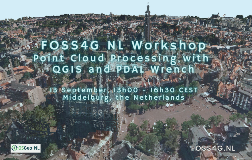
On 13 & 14 September 2023 OSGeo.nl is organising FOSS4G NL in Middelburg. On 13 September there are workshops and I'll give one in English & Dutch on processing with and wrench. More info and registration: foss4g.nl QGIS Gebruikers Nederland

On 13 & 14 September 2023 @osgeonl is organising @foss4gnl in Middelburg. On 13 September there are workshops and I'll give one in English & Dutch on #pointcloud processing with #QGIS and #PDAL wrench. More info and registration: foss4g.nl @qgisnl #foss4g
account_circle
Mergin Maps(@MerginMaps) 's Twitter Profile Photo

Let's go plant some trees! We're supporters of the Treedom project, which supports projects to plant trees in rural communities around the world. So far, we've helped to plant 31 trees, which will help capture about 9.8t of CO2 over their lifetime.
treedom.net/en/organizatio…

account_circle
Anita Graser 🇪🇺🇺🇦(@underdarkGIS) 's Twitter Profile Photo

Looking for the 🐦 E𝕏IT?

is going strong on mapstodon, fosstodon, and many related instances of the fediverse.
Find me at fosstodon.org/@underdarkGIS

account_circle
🐘 Jeremy Garniaux(@mapperfr) 's Twitter Profile Photo

Friendly reminder: there's a vibrant community on ! mapstodon.space
Close to 2000 members now, and growing.
Everyone's welcome, the air is fresh and the tone is so. Much. Nicer. Plus you'll be able to connect with whoever has a Mastodon account.

account_circle
Mergin Maps(@MerginMaps) 's Twitter Profile Photo

Tracking trenches with Mergin Maps? Interesting use case for field data collection in archaeology. Headland Archaeology

headlandarchaeology.com/spotlight-on-t…
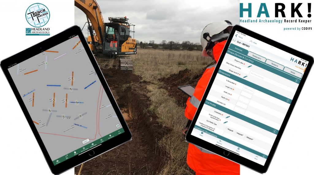
Tracking trenches with @MerginMaps? Interesting use case for field data collection in archaeology. @HeadlandArchUK headlandarchaeology.com/spotlight-on-t…
account_circle
Hans van der Kwast @hansakwast@fosstodon.org(@hansakwast) 's Twitter Profile Photo

New video: Create and Use Virtual Point Clouds (VPC) in . Nice to have these new native tools in QGIS 3.32 Lima! youtu.be/lGioykDOg3k

account_circle
Jin Igarashi(@j_igarashi) 's Twitter Profile Photo

Also, I have just done translation to Japanese language for Mergin Maps. Current version is 2.1.1, I am not sure when next release will be. I believe Japanese translation will be available from next version. Now I have completed translating both compatible mobile apps

Also, I have just done translation to Japanese language for @MerginMaps. Current version is 2.1.1, I am not sure when next release will be. I believe Japanese translation will be available from next version. Now I have completed translating both #QGIS compatible mobile apps
account_circle
OSGeo https://fosstodon.org/@osgeo(@OSGeo) 's Twitter Profile Photo

Howard Butler @[email protected]
was honoured with the 2023 Sol Katz Award, presented on 30 June 2023 at in , Kosovo. Congratulations from ! Well deserved!
Read more about the award osgeo.org/foundation-new…

Howard Butler @howardbutler was honoured with the 2023 Sol Katz Award, presented on 30 June 2023 at #FOSS4G2023 in #Prizren, Kosovo. Congratulations from #osgeo! Well deserved! #foss4g Read more about the award osgeo.org/foundation-new…
account_circle
@lutraconsulting@fosstodon.org(@lutraconsulting) 's Twitter Profile Photo

A very interesting read on how is using Mergin Maps and to collect ground control points for georeferencing their LIDAR and aerial imagery:
merginmaps.com/case-studies/m…

A very interesting read on how #ignfi is using @MerginMaps and #QGIS to collect ground control points for georeferencing their LIDAR and aerial imagery: merginmaps.com/case-studies/m…
account_circle
Mergin Maps(@MerginMaps) 's Twitter Profile Photo

Check out our latest tutorial from Peter Petrik about how to use Mergin Maps API to move photos from Mergin Maps to MinIO/S3. This is a great trick to reduce workspace size and speed up project loading times! youtu.be/jAElsCZRBdc

account_circle
MapScaping(@MapScaping) 's Twitter Profile Photo

. @[email protected] has introduced native point cloud processing in the latest release of @QGIS 3.32

lutraconsulting.co.uk/blog/2023/05/3…

. @lutraconsulting has introduced native point cloud processing in the latest release of @QGIS 3.32 lutraconsulting.co.uk/blog/2023/05/3…
account_circle