NWS Wilmington OH(@NWSILN) 's Twitter Profileg
NWS Wilmington OH

@NWSILN

Official Twitter Account for National Weather Service Wilmington OH. Details: https://t.co/IijUOKgDR8

ID:609287853

linkhttp://weather.gov/iln calendar_today15-06-2012 15:44:22

23,7K Tweet

52,0K Takipçi

92 Takip Edilen

NWS Wilmington OH(@NWSILN) 's Twitter Profile Photo

Thanks for joining us this week for
You can find weather safety & preparedness videos w/ & captions at ow.ly/cWzP50KSqK8 Thanks to all NWS offices that provided videos!

account_circle
NWS Wilmington OH(@NWSILN) 's Twitter Profile Photo

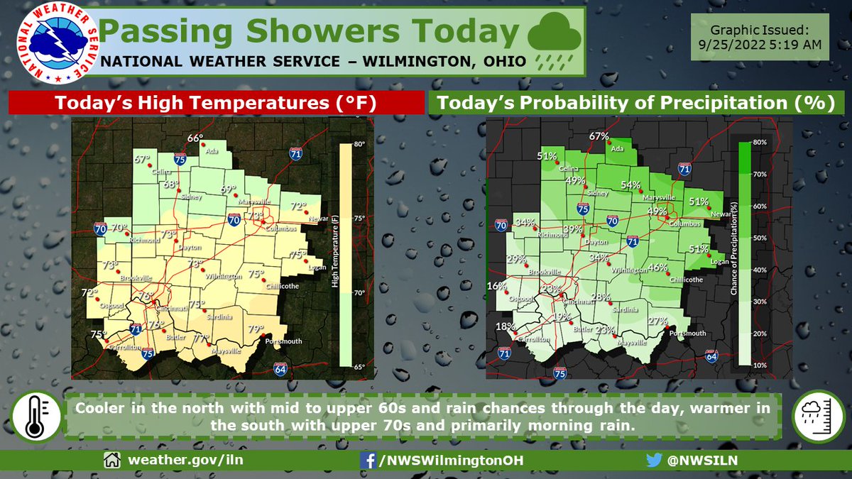
[12:33 PM] An area of low pressure over the Great Lakes is moving only very slowly. This will keep clouds, along with some showers and storms, in the forecast for parts of the area today.

account_circle
NWS Wilmington OH(@NWSILN) 's Twitter Profile Photo

Showers and thunderstorms will pass east through the region this morning. Another round of showers and storms will enter into areas along and especially north of the I-70 corridor later in the day.

Showers and thunderstorms will pass east through the region this morning. Another round of showers and storms will enter into areas along and especially north of the I-70 corridor later in the day.
account_circle
NWS Wilmington OH(@NWSILN) 's Twitter Profile Photo

[7:55 PM] Expect increasing clouds overnight with a chance of showers, partial clearing during the morning, and then isolated showers late Sunday afternoon.

[7:55 PM] Expect increasing clouds overnight with a chance of showers, partial clearing during the morning, and then isolated showers late Sunday afternoon.
account_circle
NWS Wilmington OH(@NWSILN) 's Twitter Profile Photo

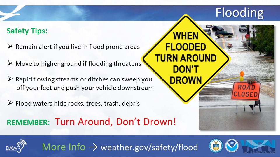
It is NEVER safe to drive or walk through flood waters. REMEMBER: Turn Around Don’t Drown! Learn more about flood safety: ow.ly/lpFW50KS7aV

It is NEVER safe to drive or walk through flood waters. REMEMBER: Turn Around Don’t Drown! Learn more about flood safety: ow.ly/lpFW50KS7aV #DeafAwarenessWeek #IWDeaf
account_circle
NWS Wilmington OH(@NWSILN) 's Twitter Profile Photo

[8:06 AM] Scattered showers quickly move out this morning, but cloud cover lingers into the afternoon. Expect these clouds to begin clearing from late afternoon to evening from west to east.

account_circle
NWS Aberdeen(@NWSAberdeen) 's Twitter Profile Photo

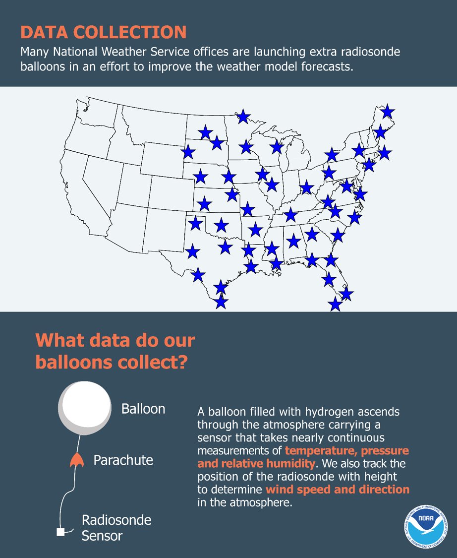
In support of the National Hurricane Center with Tropical Depression 9, we will begin launching 2 extra upper-air balloons per day starting tomorrow. Multiple NWS offices will take part in this effort. For more information about this storm, visit hurricanes.gov.

In support of the National Hurricane Center with Tropical Depression 9, we will begin launching 2 extra upper-air balloons per day starting tomorrow. Multiple NWS offices will take part in this effort. For more information about this storm, visit hurricanes.gov.
account_circle
NWS Wilmington OH(@NWSILN) 's Twitter Profile Photo

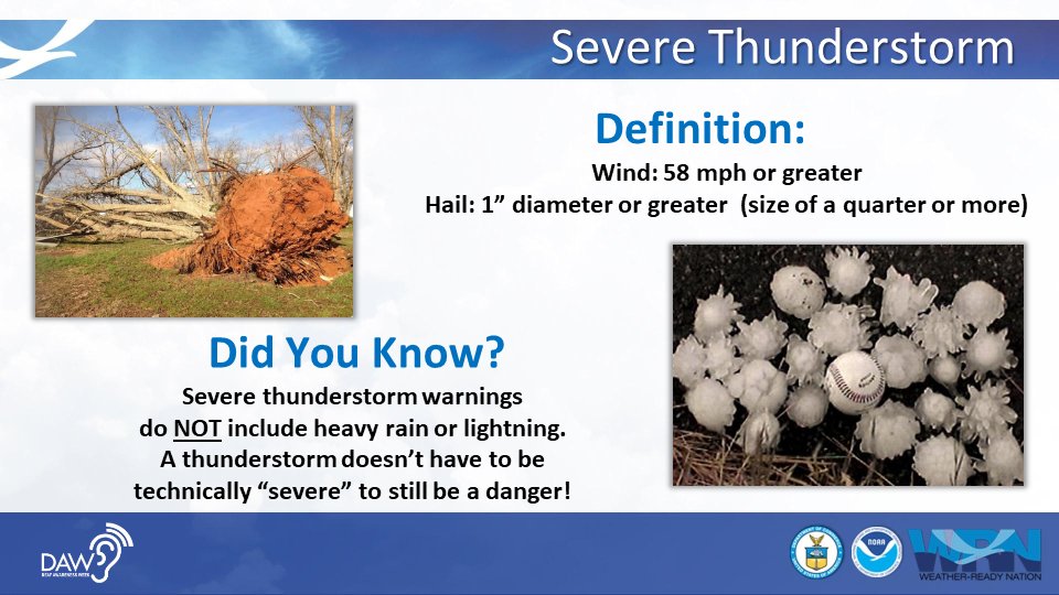
Did You Know - Severe thunderstorms can produce straight line winds that can cause just as much, if not more, damage than a tornado?
youtube.com/watch?v=ooNllC…

Did You Know - Severe thunderstorms can produce straight line winds that can cause just as much, if not more, damage than a tornado? youtube.com/watch?v=ooNllC…
account_circle
NWS Wilmington OH(@NWSILN) 's Twitter Profile Photo

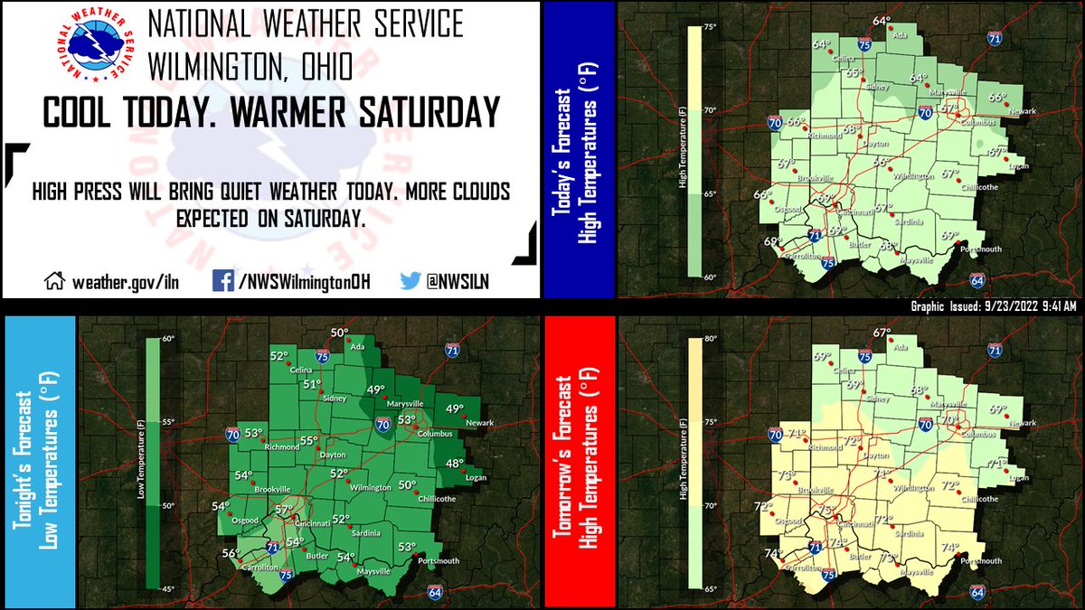
Mostly sunny and cool conditions are expected today as high pressure continues to build south into the region. Clouds increase tonight with some clouds lingering into Saturday. Southerly flow on Saturday will bring warmer temperatures.

Mostly sunny and cool conditions are expected today as high pressure continues to build south into the region. Clouds increase tonight with some clouds lingering into Saturday. Southerly flow on Saturday will bring warmer temperatures.
account_circle
NWS Wilmington OH(@NWSILN) 's Twitter Profile Photo

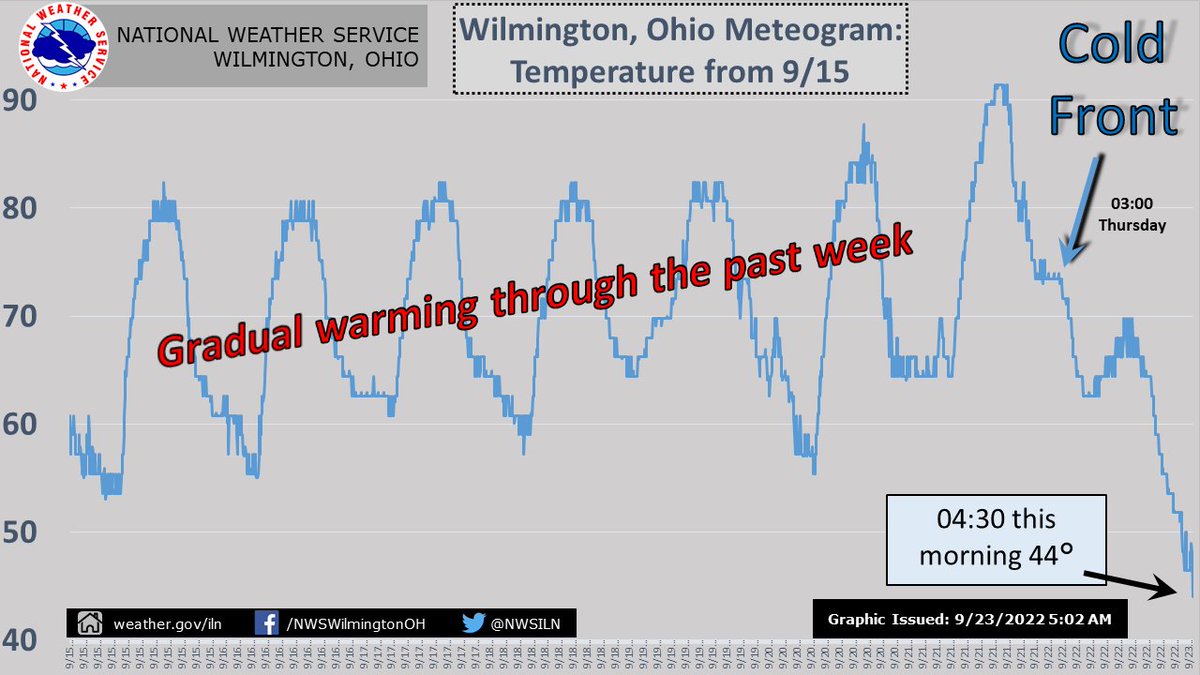
It was a clear, cool and crisp morning! Lots of 40s for lows and even a few 30s. Too cold or refreshing? Let us know!
ow.ly/Uamj50KRkv5

account_circle
NWS Wilmington OH(@NWSILN) 's Twitter Profile Photo

The last time we saw widespread low temperatures in the 40s was back on May 8, when it dropped to 47 in Cincinnati, 40 in Columbus, 41 in Dayton and Richmond, and 43 in Wilmington. May 24 had a handful of observations drop to the upper 40s.

The last time we saw widespread low temperatures in the 40s was back on May 8, when it dropped to 47 in Cincinnati, 40 in Columbus, 41 in Dayton and Richmond, and 43 in Wilmington. May 24 had a handful of observations drop to the upper 40s.
account_circle
NWS Wilmington OH(@NWSILN) 's Twitter Profile Photo

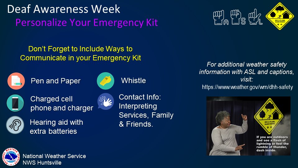
Every individual can take important steps to prepare for weather emergencies. An emergency communication plan is critical for everyone. Do you have a plan or a kit? Video w/ : youtu.be/ZLLMDOScE4g

Every individual can take important steps to prepare for weather emergencies. An emergency communication plan is critical for everyone. Do you have a plan or a kit? Video w/ #ASL: youtu.be/ZLLMDOScE4g #DeafAwarenessWeek #IWDeaf
account_circle
NWS Wilmington OH(@NWSILN) 's Twitter Profile Photo

[4:02 PM] High pressure, clearing skies, and calming winds will help support below normal temperatures for Friday morning with values dropping to their coolest point since early May (8th). Upper 30s are most likely across eastern Indiana and western Ohio.

[4:02 PM] High pressure, clearing skies, and calming winds will help support below normal temperatures for Friday morning with values dropping to their coolest point since early May (8th). Upper 30s are most likely across eastern Indiana and western Ohio.
account_circle
NWS Cleveland(@NWSCLE) 's Twitter Profile Photo

NWS CLE, NWS ILN, and ODOT met in person in Columbus to discuss upcoming changes to the winter weather program. Partner meetings are very important for networking and listening to feedback.

NWS CLE, NWS ILN, and ODOT met in person in Columbus to discuss upcoming changes to the winter weather program. Partner meetings are very important for networking and listening to feedback. #ohwx
account_circle
NWS Wilmington OH(@NWSILN) 's Twitter Profile Photo

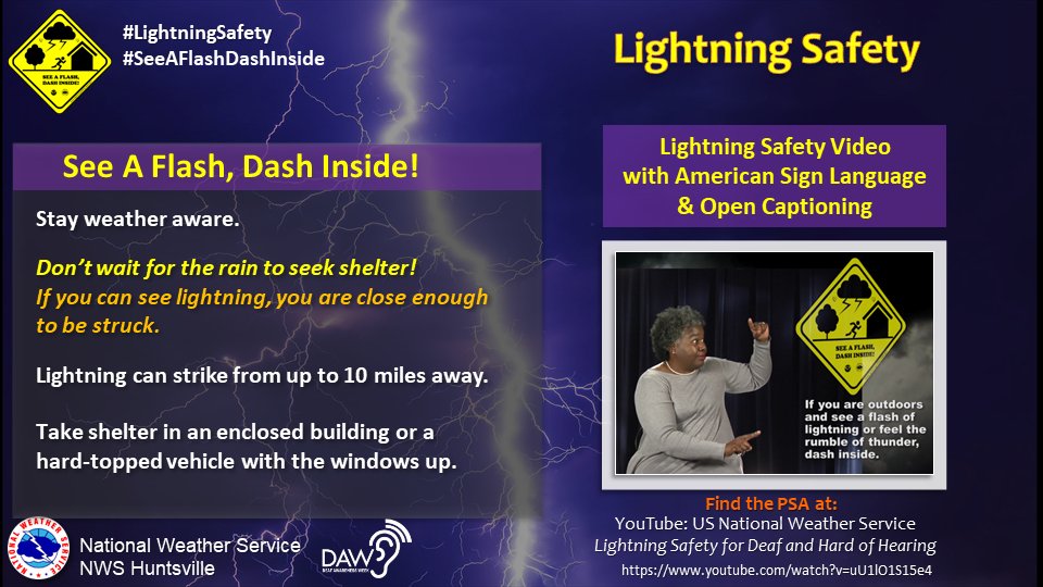
Whatever your outdoor plans are: When you See a Flash, Dash Inside! It's never safe to be outside when lightning is in the area. ow.ly/Rfyj50KQnzW

Whatever your outdoor plans are: When you See a Flash, Dash Inside! It's never safe to be outside when lightning is in the area. ow.ly/Rfyj50KQnzW #SeeAFlashDashInside #DeafAwarenessWeek #IWDeaf
account_circle
NWS Wilmington OH(@NWSILN) 's Twitter Profile Photo

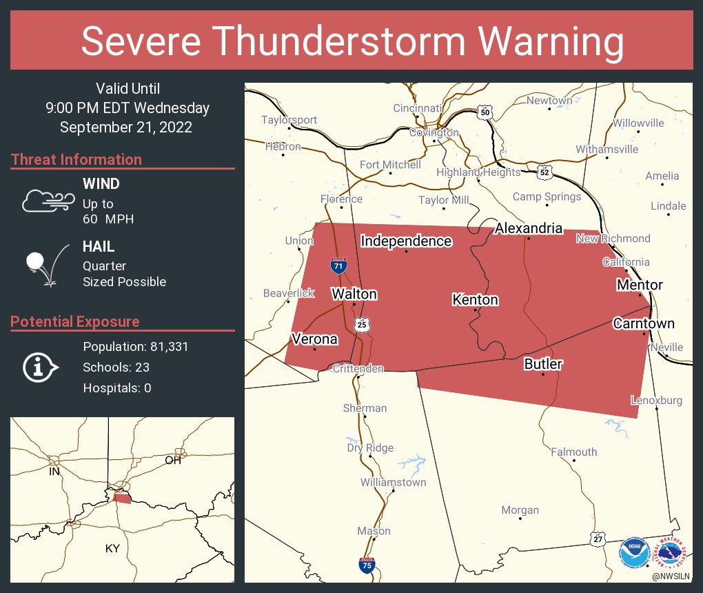
[10:50 PM] The severe threat has diminished, but there remains a chance for showers and storms overnight along a strong cold front that will push east across our area. In fact, the current temperatures are the warmest we'll see until a warmup on Saturday.

[10:50 PM] The severe threat has diminished, but there remains a chance for showers and storms overnight along a strong cold front that will push east across our area. In fact, the current temperatures are the warmest we'll see until a warmup on Saturday.
account_circle