Alemu Gonsamo (@alemugonsamo) 's Twitter Profile
Alemu Gonsamo

@alemugonsamo

Associate Professor & Tier 2 Canada Research Chair | Remote Sensing of Terrestrial Ecosystems | School of Earth, Environment & Society @McMasterSEES @McMasterU

ID: 1051891905968201729

linkhttps://remotesensing-mcmaster.org/ calendar_today15-10-2018 17:45:48

522 Tweet

1,1K Takipçi

953 Takip Edilen
Laura Duncanson (@lauraduncanson) 's Twitter Profile Photo

Extremely exciting news for the future of Satellite #lidar! #EDGE has been selected to the next round by NASA! What is EDGE? Led by the amazing PI Helen Amanda Fricker ❄️❄️ ❄️🧊 and Deputy PI John Armston 🌳 this would be the natural continuity of both GEDI and ICESat-2
Martin Brandt (@matin_brandt) 's Twitter Profile Photo

We mapped a half billion individual farmland trees in India, and tracked their fate over a decade. Many large trees have disappeared. The paper in Nature Sus.: doi.org/10.1038/s41893…, Viewer: rs-cph.projects.earthengine.app/view/tree. It's a new framework for temporal monitoring of single trees..

Mac HydroMet (@mac_hydromet) 's Twitter Profile Photo

NEW PAPER: impacts of spongy moth on forest productivity and carbon in Great Lakes deciduous forests. Results showed a significant reduction in leaf area index (LAI) and gross primary productivity (GPP). link.springer.com/article/10.118… #mcmaster #remotesensing #Sentinel2 #Eddycovariance

NEW PAPER: impacts of spongy moth on forest productivity and carbon in Great Lakes deciduous forests. Results showed a significant reduction in leaf area index (LAI) and gross primary productivity (GPP).
link.springer.com/article/10.118…
#mcmaster #remotesensing #Sentinel2 #Eddycovariance
Remote Sensing MDPI (@remotesens_mdpi) 's Twitter Profile Photo

#editorchoice 🌳Spatially Continuous Mapping of #Forest #Canopy Height in Canada by Combining #GEDI and #ICESat-2 with PALSAR and #Sentinel by Camile Sothe, Alemu Gonsamo, Ricardo B. Lourenço, Werner A. Kurz and James Snider mdpi.com/2072-4292/14/2… #forest

#editorchoice
🌳Spatially Continuous Mapping of #Forest #Canopy Height in Canada by Combining #GEDI and #ICESat-2 with PALSAR and #Sentinel
by Camile Sothe, Alemu Gonsamo, Ricardo B. Lourenço, Werner A. Kurz and James Snider 

mdpi.com/2072-4292/14/2…
#forest
Philippe.ciais (@ciais_philippe) 's Twitter Profile Photo

🌱 Do plants allocate more carbon in roots or in leaves under warming in a cold alpine region ? 🌱 Answers in our PNASNews publication led by the great Hanbo Yun pnas.org/doi/10.1073/pn…

🌱  Do plants allocate more carbon in roots or in leaves under warming in a cold alpine region ?

🌱 Answers in our <a href="/PNASNews/">PNASNews</a> publication led by the great Hanbo Yun

pnas.org/doi/10.1073/pn…
Alemu Gonsamo (@alemugonsamo) 's Twitter Profile Photo

If you are at the Canadian Symposium on Remote Sensing check out our lab's presentation, wildfire carbon emissions by Zilong Zhong and peat depth mapping by Yiyao Li this afternoon, canopy height mapping by José Bermúdez and UAV LiDAR biomass estimation by Kangyu So tomorrow
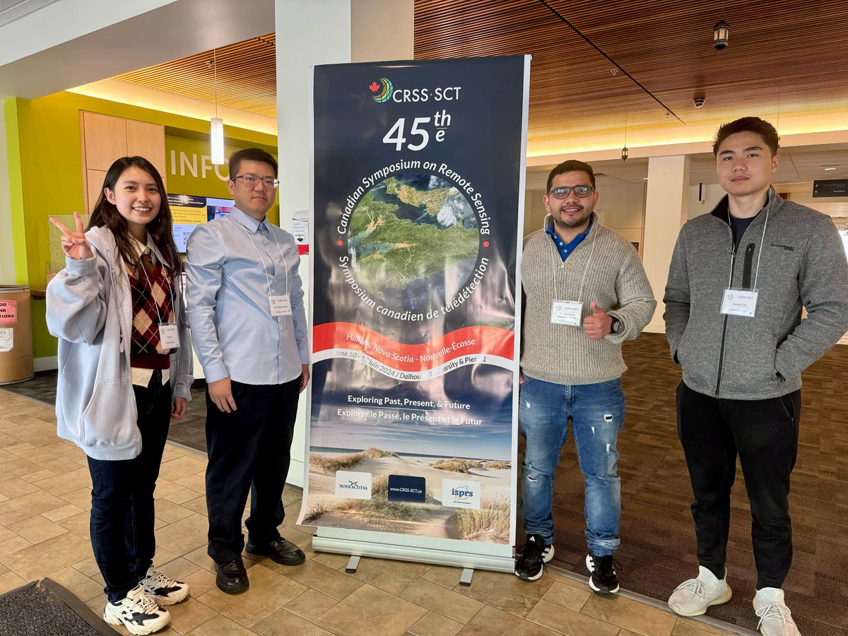
If you are at the Canadian Symposium on Remote Sensing check out our lab's presentation, wildfire carbon emissions by <a href="/zilong_zhong/">Zilong Zhong</a> and peat depth mapping by Yiyao Li this afternoon, canopy height mapping by <a href="/josebermudez/">José Bermúdez</a> and UAV LiDAR biomass estimation by <a href="/SoKangyu/">Kangyu So</a> tomorrow
Alemu Gonsamo (@alemugonsamo) 's Twitter Profile Photo

We have a new preprint on Earth & Space Science Open Archive mapping peat depth and carbon storage of the Hudson Bay Lowlands. Peat depth increases with increasing distance from the coastline due to ongoing glacial isostatic adjustment since ice retreat began. essopenarchive.org/doi/full/10.22…

We have a new preprint on <a href="/ESSOpenArchive/">Earth & Space Science Open Archive</a> mapping peat depth and carbon storage of the Hudson Bay Lowlands. Peat depth increases with increasing distance from the coastline due to ongoing glacial isostatic adjustment since ice retreat began. essopenarchive.org/doi/full/10.22…
Mark Parrington (@m_parrington) 's Twitter Profile Photo

A Global Probability‐Of‐Fire (PoF) Forecast - using machine learning to forecast global fire activity up to 10 days at 9 & 1 km led by Joe McNorton & ECMWF colleagues published in Geophysical Research Letters Copernicus ECMWF Copernicus EMS AGU (American Geophysical Union) agupubs.onlinelibrary.wiley.com/doi/10.1029/20…

Chinyere Ottah (@chinyereottah) 's Twitter Profile Photo

See you at the conference! #BESTEMM2024 #BESTEMM24 #CanadianBlackScientists #WildfireResearch #RemoteSensing #MachineLearning #PhDLife

See you at the conference!

#BESTEMM2024 #BESTEMM24 #CanadianBlackScientists #WildfireResearch #RemoteSensing #MachineLearning #PhDLife
Philippe.ciais (@ciais_philippe) 's Twitter Profile Photo

🚨 Collapse of the land carbon sink in 2023 🚨 As the CO2 growth rate reached a record high at Mauna Loa, we set up a low-latency analysis of the carbon budget and found that plants and soils absorbed almost no CO2 last year GlobalCarbonProject Gianpaolo Balsamo arxiv.org/abs/2407.12447
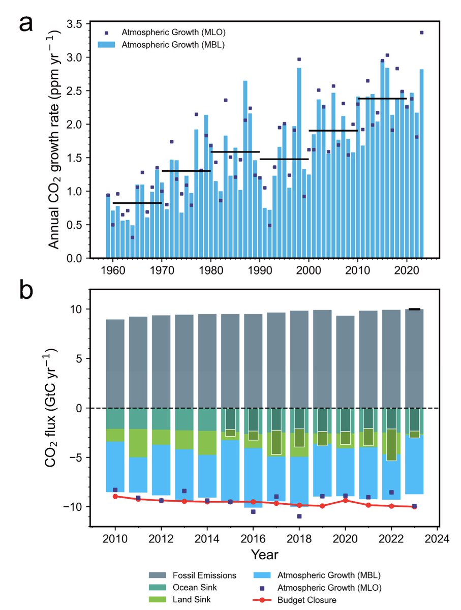
🚨 Collapse of the land carbon sink in 2023 🚨

As the CO2 growth rate reached a record high at Mauna Loa, we set up a low-latency analysis of the carbon budget and found that plants and soils absorbed almost no CO2 last year  <a href="/gcarbonproject/">GlobalCarbonProject</a> <a href="/gpbalsamo/">Gianpaolo Balsamo</a> 

arxiv.org/abs/2407.12447
Chinyere Ottah (@chinyereottah) 's Twitter Profile Photo

Today at BE-STEMM, I spoke about our research at the Gonsamo Group on quantifying carbon emissions from wildfires in Canada using machine learning. Special thanks to my co-authors: Zilong Zhong , Cheryl Rogers 🇨🇦 , José Bermúdez , and Alemu Gonsamo. #Wildfire #RemoteSensing #ML
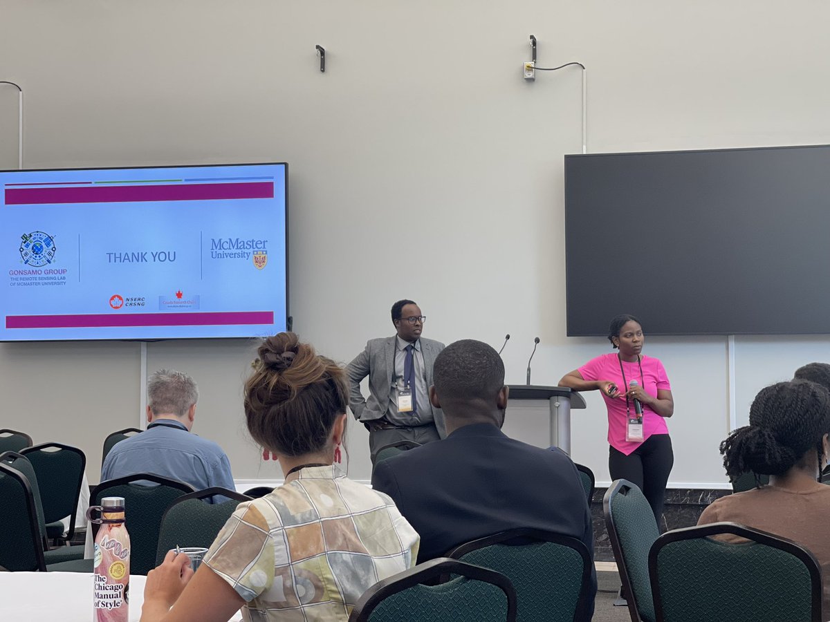
Today at BE-STEMM, I spoke about our research at the Gonsamo Group on quantifying carbon emissions from wildfires in Canada using machine learning. Special thanks to my co-authors: <a href="/zilong_zhong/">Zilong Zhong</a> , <a href="/ky_rell/">Cheryl Rogers 🇨🇦</a> , <a href="/josebermudez/">José Bermúdez</a> , and <a href="/AlemuGonsamo/">Alemu Gonsamo</a>.

 #Wildfire #RemoteSensing #ML
Alemu Gonsamo (@alemugonsamo) 's Twitter Profile Photo

The Hudson Bay Lowlands peat depth, carbon stock, ground measurements and associated datasets are now online here: doi.org/10.5683/SP3/TI… We also have wet and dry peat spectral measurements for full peat depth at 5cm interval for anyone interested.

Martin Girardin (@girardinmartin) 's Twitter Profile Photo

New paper published in Nature Communications The 2023 fire season in Canada is a wake-up call: severe climate impacts on fire activity are arriving decades earlier than predicted. Building fire-resilient environments is now more critical than ever! Natural Resources CEF_CFR nature.com/articles/s4146…

Canadian Journal of Forest Research (@canjforestres) 's Twitter Profile Photo

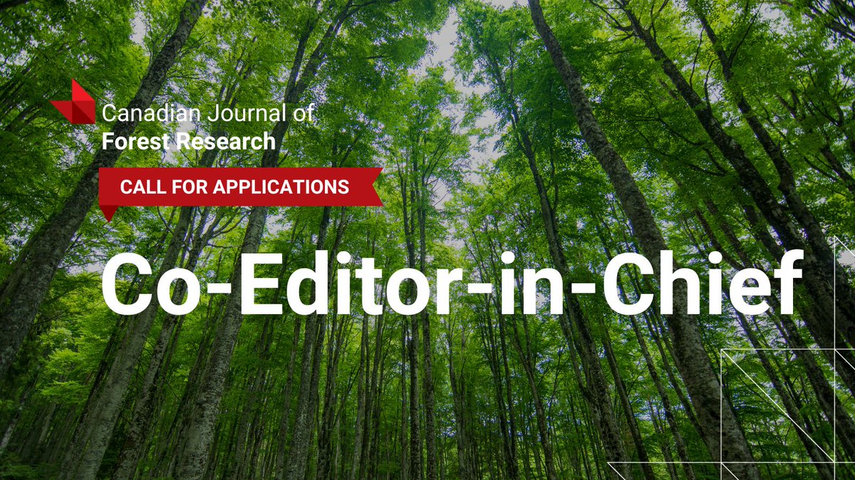
👩‍🔬🌲 Take the lead in forest science! We're hiring a co-Editor-in-Chief! If you're committed to excellence, diversity, and innovation in forest research, we want to hear from you! Apply by Sept 1, 2024 ➡️ ow.ly/GjzN50SW9h0 #ScienceEditor #ResearchLeadership

👩‍🔬🌲 Take the lead in forest science! We're hiring a co-Editor-in-Chief! If you're committed to excellence, diversity, and innovation in forest research, we want to hear from you! Apply by Sept 1, 2024 ➡️ ow.ly/GjzN50SW9h0 #ScienceEditor #ResearchLeadership