National Weather Service(@NWS) 's Twitter Profileg
National Weather Service

@NWS

Official Twitter account for @NOAA's National Weather Service.
A list of official NWS accounts can be found at https://t.co/x5itrXGTJT

ID:454313925

linkhttp://weather.gov calendar_today03-01-2012 21:24:25

41,7K Tweets

3,1M Followers

328 Following

Follow People
NWS Storm Prediction Center(@NWSSPC) 's Twitter Profile Photo

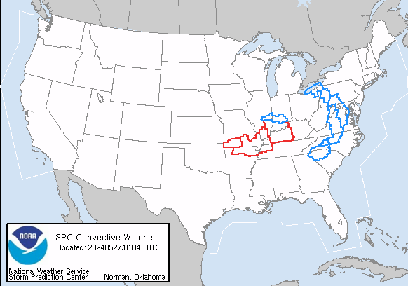
One of the duties of the SPC meso-assistant forecasters is to monitor and update active watches. SPC currently has 9 active watches across the CONUS! We need more desk space for the watch printouts!

Stay weather aware, Weather Watch info available here: spc.noaa.gov/products/watch/

One of the duties of the SPC meso-assistant forecasters is to monitor and update active watches. SPC currently has 9 active watches across the CONUS! We need more desk space for the watch printouts! Stay weather aware, Weather Watch info available here: spc.noaa.gov/products/watch/
account_circle
NWS Weather Prediction Center(@NWSWPC) 's Twitter Profile Photo

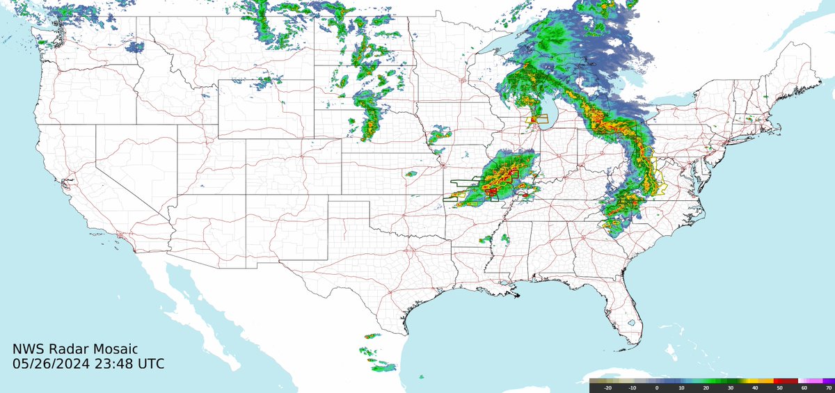
Strong thunderstorms continue to impact parts of the central and eastern U.S. this evening with severe weather and heavy rain, as seen in the attached latest national radar mosaic. Be sure to remain weather aware overnight and have multiple ways to receive warnings.

Strong thunderstorms continue to impact parts of the central and eastern U.S. this evening with severe weather and heavy rain, as seen in the attached latest national radar mosaic. Be sure to remain weather aware overnight and have multiple ways to receive warnings.
account_circle
NWS Wilmington OH(@NWSILN) 's Twitter Profile Photo

An evening severe threat remains possible despite the afternoon thunderstorms. For NWS Wilmington OH's local area, the highest threat will be across southeast Indiana, southwest Ohio, and northern Kentucky between 10 PM - 1 AM. Additional watches and warnings may be necessary. Stay tuned.
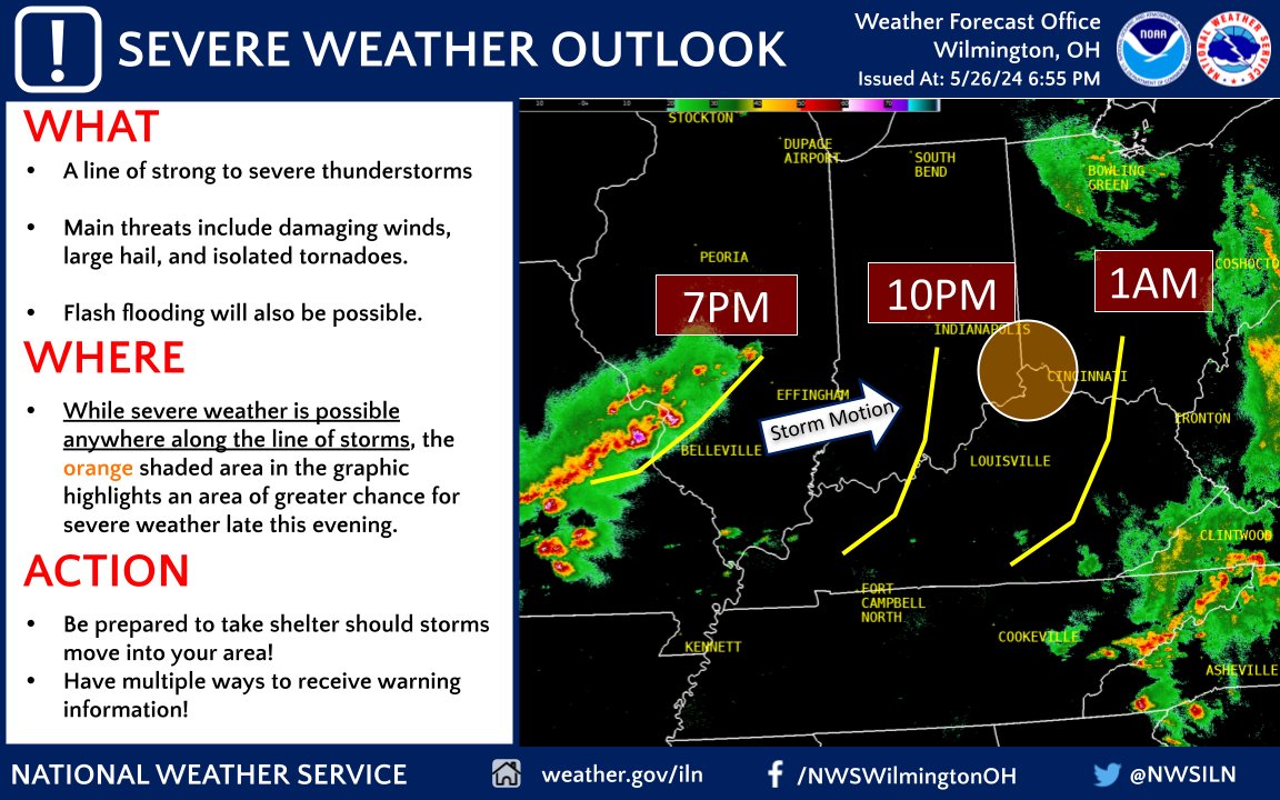
An evening severe threat remains possible despite the afternoon thunderstorms. For @NWSILN's local area, the highest threat will be across southeast Indiana, southwest Ohio, and northern Kentucky between 10 PM - 1 AM. Additional watches and warnings may be necessary. Stay tuned.
account_circle
National Weather Service(@NWS) 's Twitter Profile Photo

The risk for a couple brief tornadoes looks to continue for the next hour or two in southeast Wisconsin and far northern Illinois. The threat should quickly wane as storms approach the lake.

account_circle
NWS Charleston, WV(@NWSCharlestonWV) 's Twitter Profile Photo

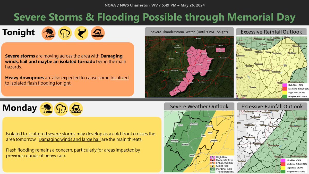
Damaging winds are being reported along a line of severe storms moving across the area . Hail and an isolated tornado cannot be ruled out. Flash flooding is also a concern with heavy downpours. Another round of storms and flooding expected tomorrow.

Damaging winds are being reported along a line of severe storms moving across the area . Hail and an isolated tornado cannot be ruled out. Flash flooding is also a concern with heavy downpours. Another round of storms and flooding expected tomorrow. #WVWX #OHwx #kywx #VAWX
account_circle
NWS Nashville(@NWSNashville) 's Twitter Profile Photo

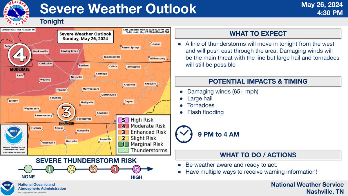
⚠️We are seeing a break in activity but don't let that fool you. We are going to see a line of strong storms push in tonight after 9 PM. Strong damaging winds will be the main concern but tornadoes and large hail are still possible. Stay weather aware!

⚠️We are seeing a break in activity but don't let that fool you. We are going to see a line of strong storms push in tonight after 9 PM. Strong damaging winds will be the main concern but tornadoes and large hail are still possible. Stay weather aware! #TNwx
account_circle
NWS Paducah, KY(@NWSPaducah) 's Twitter Profile Photo

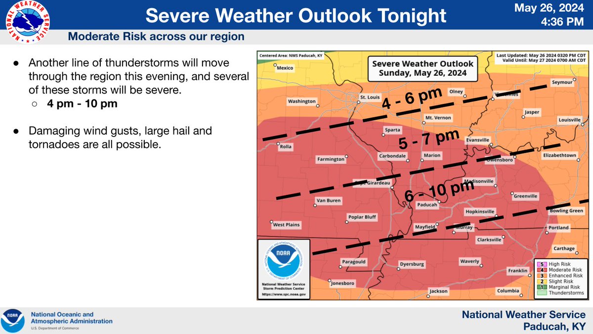
A look at the severe weather outlook, timing estimate along with the severe weather threat this afternoon into this evening. All severe threats are possible, damaging winds (hurricane force), very large hail, strong tornadoes and significant flash flooding.

A look at the severe weather outlook, timing estimate along with the severe weather threat this afternoon into this evening. All severe threats are possible, damaging winds (hurricane force), very large hail, strong tornadoes and significant flash flooding.
account_circle
NWS Morristown(@NWSMorristown) 's Twitter Profile Photo

Active weather continues to take place across the area. Please make sure to have multiple ways to receive warnings so you can take appropriate action.

Active weather continues to take place across the area. Please make sure to have multiple ways to receive warnings so you can take appropriate action.
account_circle
NWS MARFC(@NWSMARFC) 's Twitter Profile Photo

[6PM Sunday] Much of the Mid-Atlantic will be seeing significant rainfall over the next day with greatest amounts within the MARFC forecast region of around 2.0 in. in southern New York weather.gov/marfc/Precipit…

[6PM Sunday] Much of the Mid-Atlantic will be seeing significant rainfall over the next day with greatest amounts within the MARFC forecast region of around 2.0 in. in southern New York weather.gov/marfc/Precipit…
account_circle
NWS Severe Tstorm(@NWSSevereTstorm) 's Twitter Profile Photo

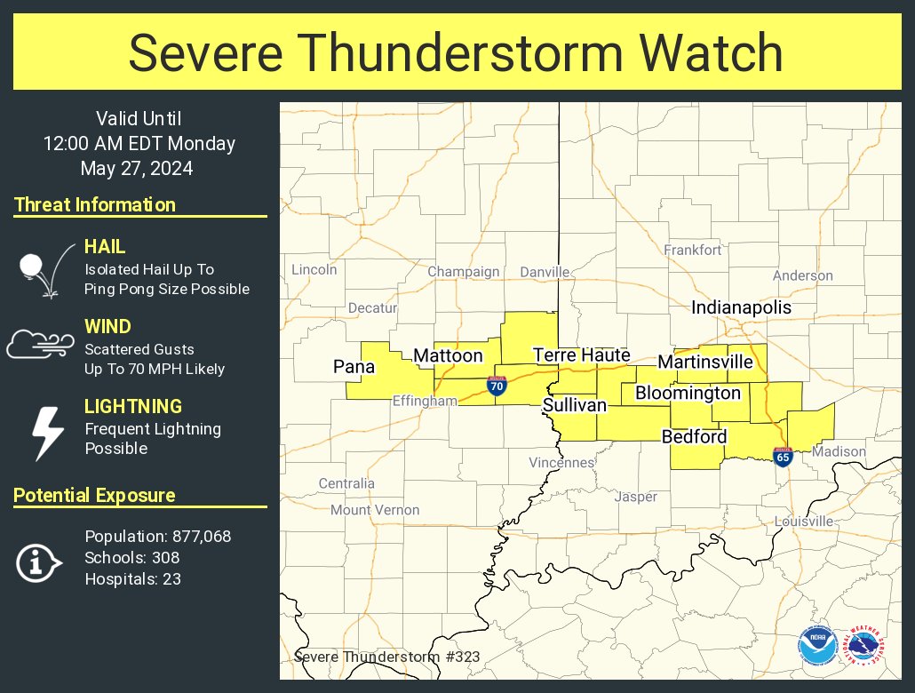
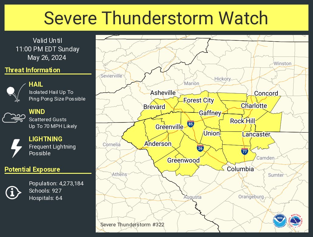
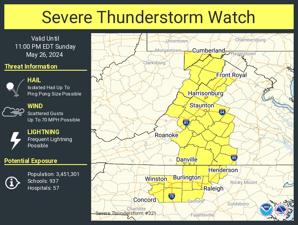
A severe thunderstorm watch has been issued for parts of Maryland, North Carolina, Virginia and West Virginia until 11 PM EDT

A severe thunderstorm watch has been issued for parts of Maryland, North Carolina, Virginia and West Virginia until 11 PM EDT
account_circle
NWS Tornado(@NWStornado) 's Twitter Profile Photo

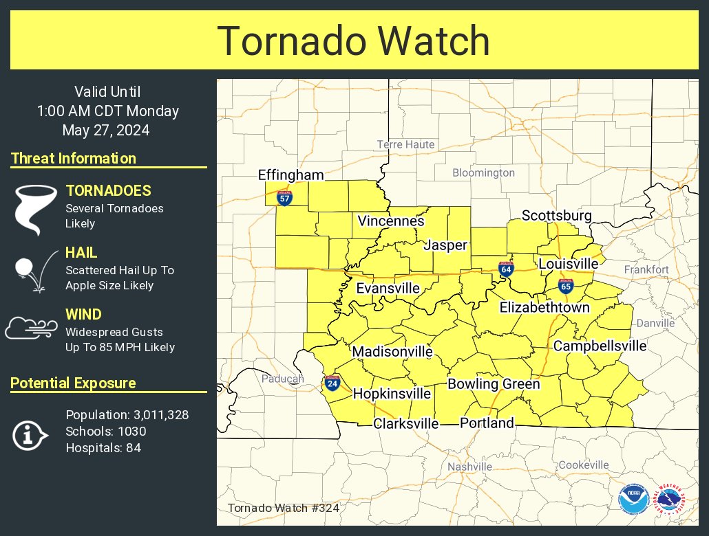
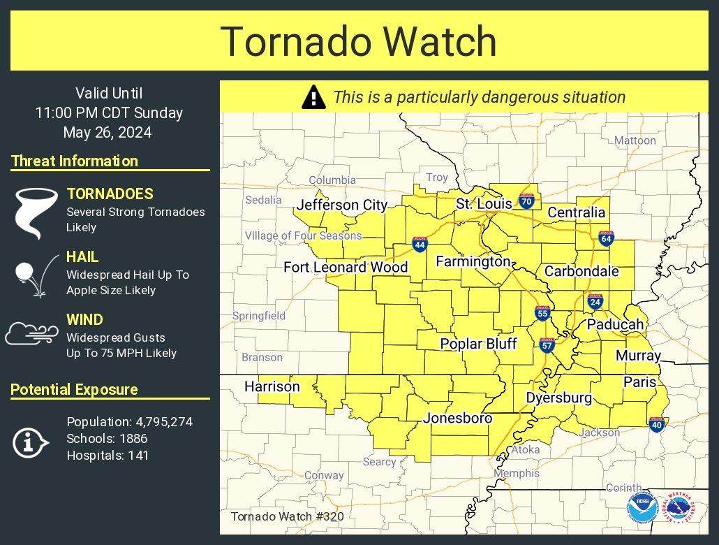
A tornado watch has been issued for parts of Arkansas, Illinois, Kentucky, Missouri and Tennessee until 11 PM CDT

A tornado watch has been issued for parts of Arkansas, Illinois, Kentucky, Missouri and Tennessee until 11 PM CDT
account_circle
NWS Storm Prediction Center(@NWSSPC) 's Twitter Profile Photo

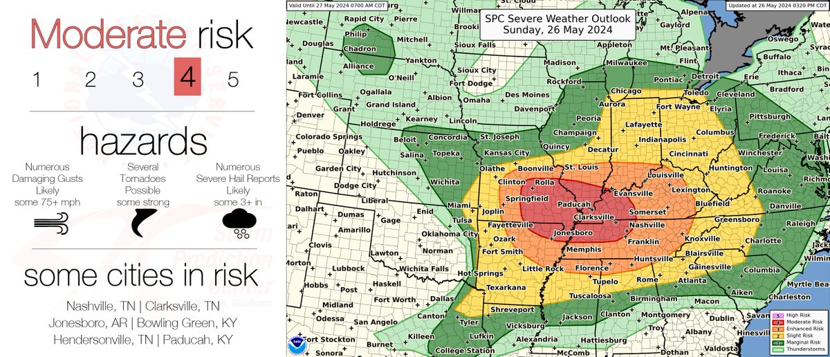
345pm CDT Update. Confidence has increased in the severe weather risk over parts of the Ozarks, Mid MS Valley and western TN Valley. A Moderate Risk (4/5) severe risk is now in place through this evening. See spc.noaa.gov for more information.

345pm CDT Update. Confidence has increased in the severe weather risk over parts of the Ozarks, Mid MS Valley and western TN Valley. A Moderate Risk (4/5) severe risk is now in place through this evening. See spc.noaa.gov for more information.
account_circle
National Weather Service(@NWS) 's Twitter Profile Photo

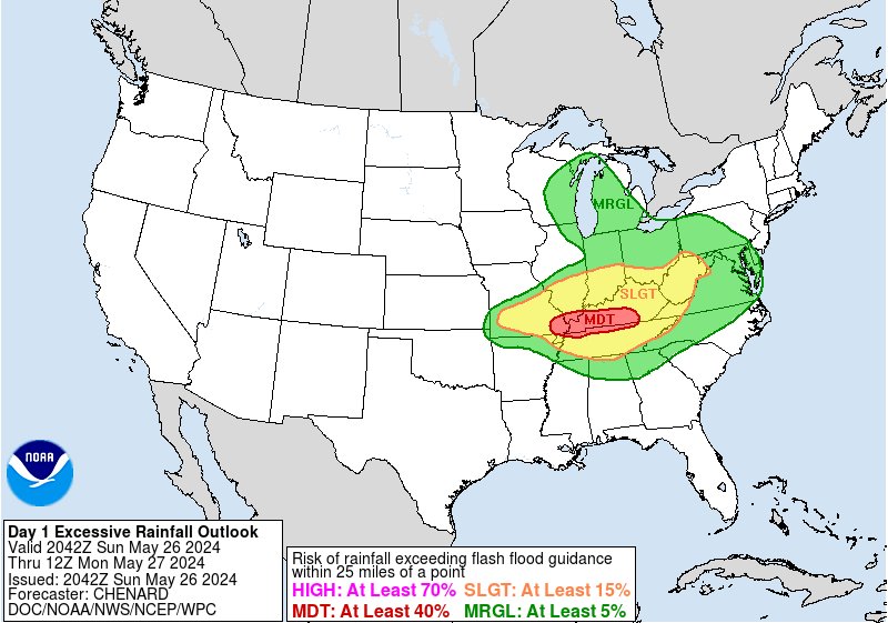
Areas of flash flooding are expected with some of it being locally significant over the next several hours across areas of central and southern MO and into southern IL, western KY, and southwest IN.

account_circle
National Weather Service(@NWS) 's Twitter Profile Photo

Who else is up for a hike this Memorial Day Weekend?

Keep in mind that it doesn’t take long for a beautiful morning to take a nasty turn. Empower yourself by being Weather-Ready. Check the forecast before enjoying any outdoor activity. Know before you go! weather.gov

Who else is up for a hike this Memorial Day Weekend? Keep in mind that it doesn’t take long for a beautiful morning to take a nasty turn. Empower yourself by being Weather-Ready. Check the forecast before enjoying any outdoor activity. Know before you go! weather.gov
account_circle