Bill Karins 💧(@BillKarins) 's Twitter Profileg
Bill Karins 💧

@BillKarins

NBC News Climate & Weather Unit, Certified Broadcast Meteorologist for NBC News, NBC News Now & MSNBC since 04' Dad, Ironman, Runner, Skier

ID:386461356

calendar_today07-10-2011 10:06:51

26,4K Tweets

38,8K Followers

1,5K Following

Colin McCarthy(@US_Stormwatch) 's Twitter Profile Photo

California's water storage is at its healthiest levels in over a decade.

Virtually every major reservoir in the state has average to above-average storage, with a substantial 115% of average snowpack still to melt.

The last two years have been an amazing reprieve from the…

California's water storage is at its healthiest levels in over a decade. Virtually every major reservoir in the state has average to above-average storage, with a substantial 115% of average snowpack still to melt. The last two years have been an amazing reprieve from the…
account_circle
Bill Karins 💧(@BillKarins) 's Twitter Profile Photo

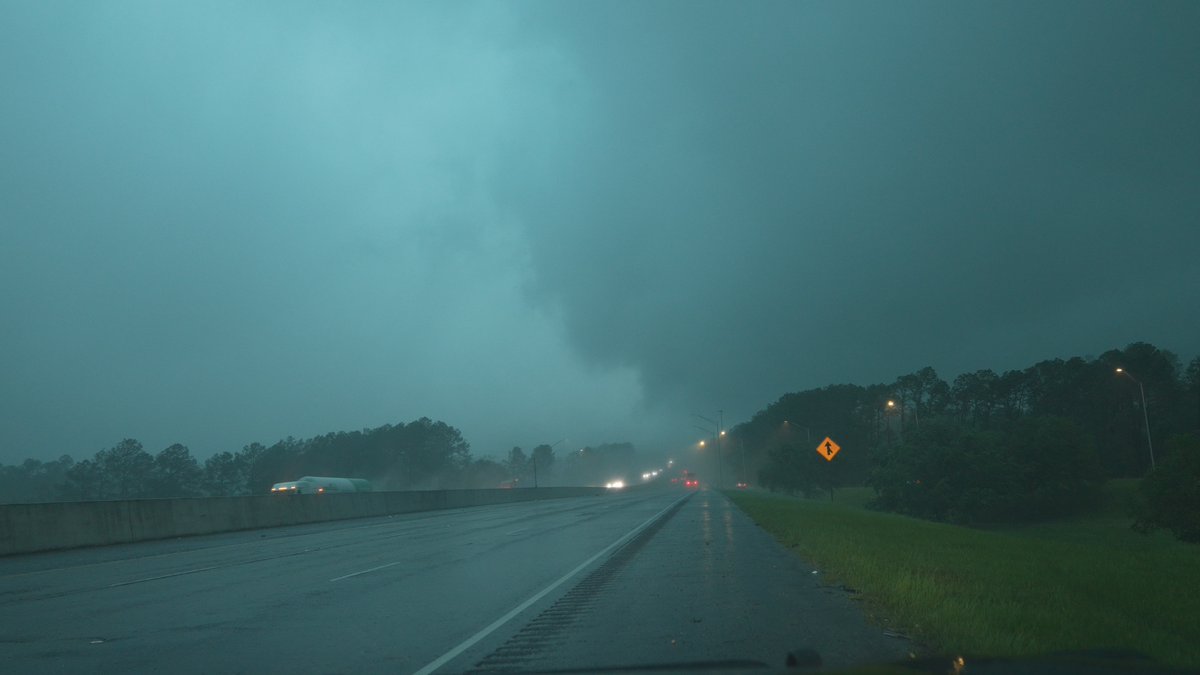
Likely pic of a wedge tornado. This was the PDS tornado warned storm west of St. Augustine, FL in the last hour

account_circle
NWS Lake Charles(@NWSLakeCharles) 's Twitter Profile Photo

Storm Surveys continue across the region this afternoon. An EF-2 tornado has been confirmed in Lake Charles. The tornado had maximum winds of 115 MPH and was on the ground for just over a mile.

Storm Surveys continue across the region this afternoon. An EF-2 tornado has been confirmed in Lake Charles. The tornado had maximum winds of 115 MPH and was on the ground for just over a mile.
account_circle
Zack Fradella(@ZackFradellaWx) 's Twitter Profile Photo

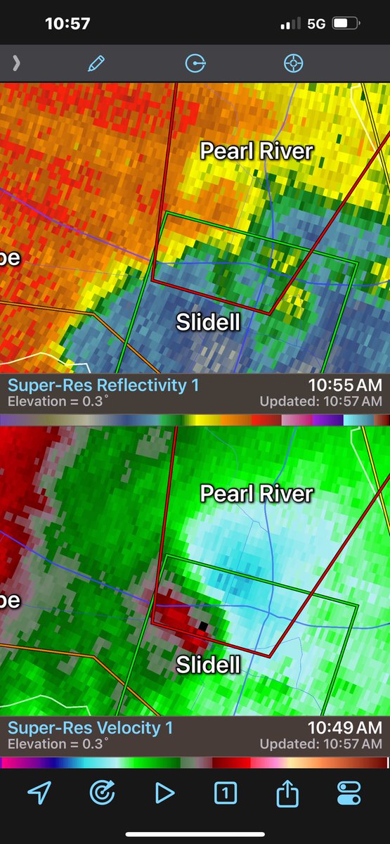
New Orleans National Weather Service confirms the Slidell tornado and a preliminary rating of an EF-1. No deaths thankfully but lots of damage 🙏🏻

New Orleans National Weather Service confirms the Slidell tornado and a preliminary rating of an EF-1. No deaths thankfully but lots of damage 🙏🏻 #lawx
account_circle
Bill Karins 💧(@BillKarins) 's Twitter Profile Photo

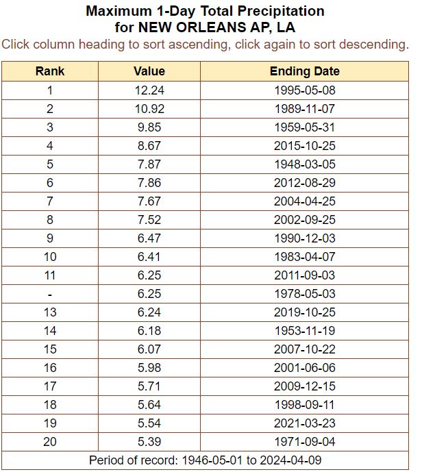
With 5.95' of rain since midnight, it is already the 17th rainiest day ever recorded at the New Orleans International Airport (MSY)

With 5.95' of rain since midnight, it is already the 17th rainiest day ever recorded at the New Orleans International Airport (MSY)
account_circle
Bill Karins 💧(@BillKarins) 's Twitter Profile Photo

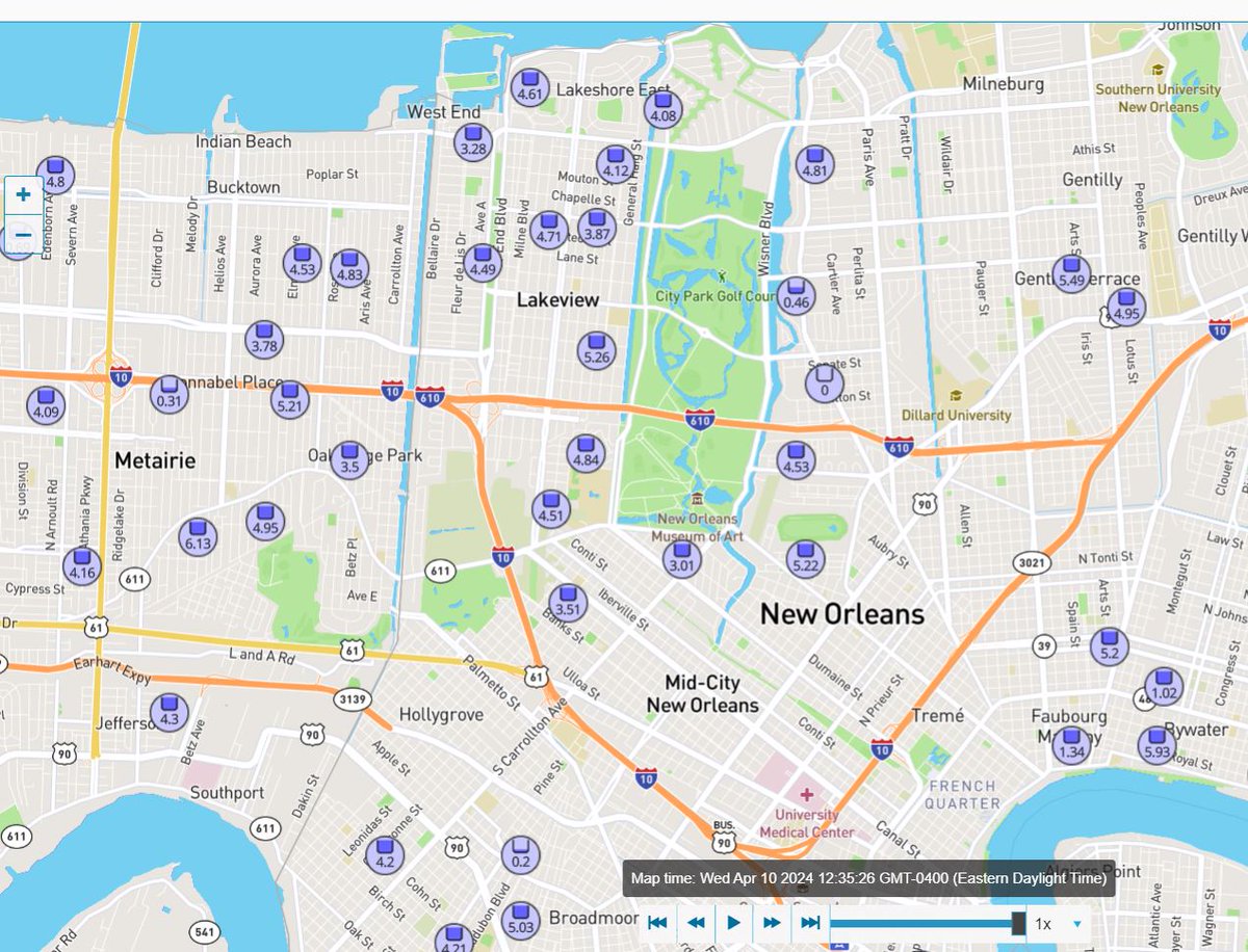
Many New Orleans rain gauges are over 4” with the highest at 6.13” in Metairie. Flash Flood Emergency continues

Many New Orleans rain gauges are over 4” with the highest at 6.13” in Metairie. Flash Flood Emergency continues
account_circle
Lee Billings(@LeeBillings) 's Twitter Profile Photo

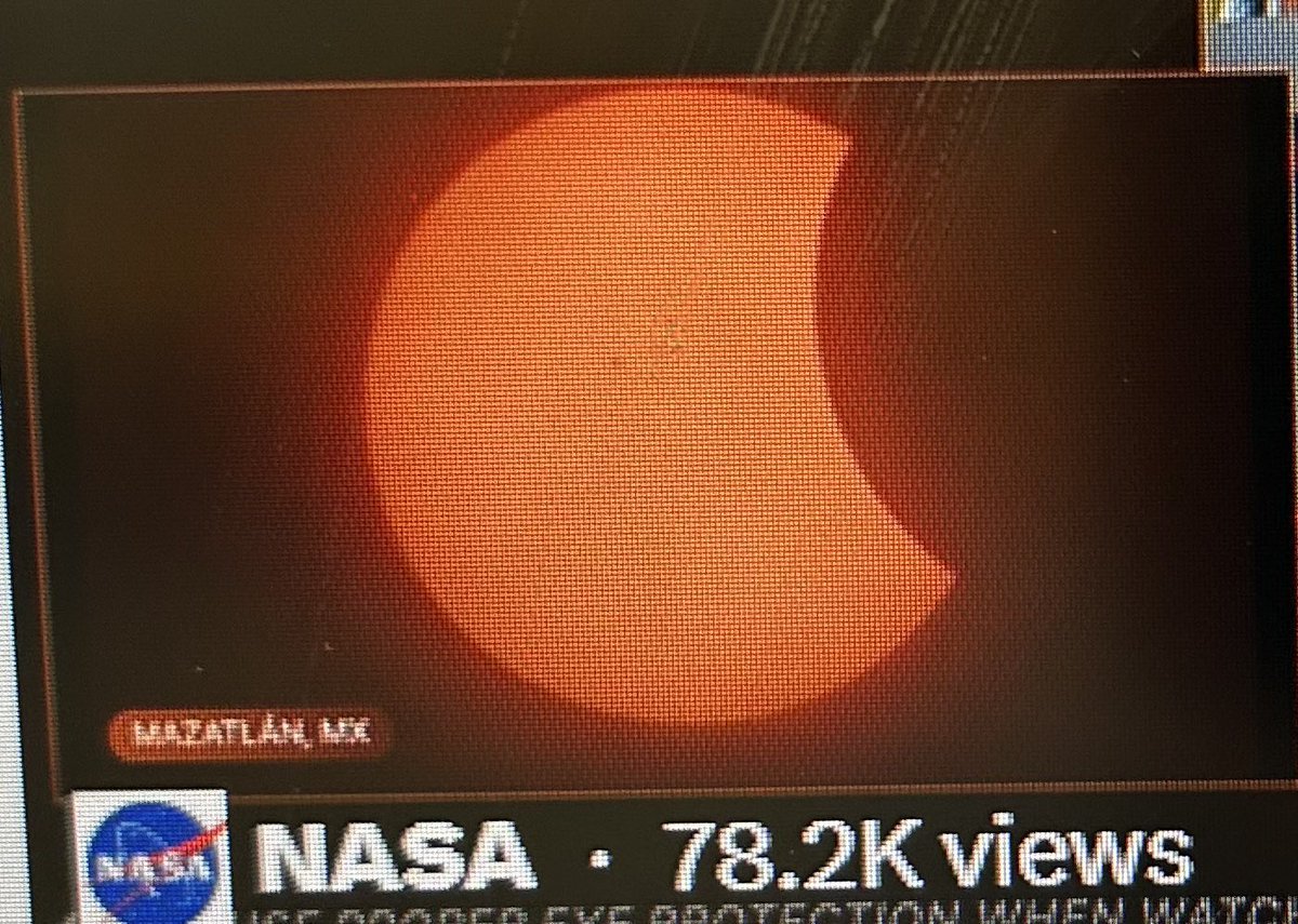
It was an honor to stand in the mid-Manhattan penumbra alongside dazzling Katy Tur & debonair Bill Karins 💧 for MSNBC’s live coverage of 2024’s Great American Eclipse—even though our concrete-jungle perch limited our view to solar reflections off a nearby skyscraper!

It was an honor to stand in the mid-Manhattan penumbra alongside dazzling @KatyTurNBC & debonair @BillKarins for @MSNBC’s live coverage of 2024’s Great American Eclipse—even though our concrete-jungle perch limited our view to solar reflections off a nearby skyscraper!
account_circle
Bill Karins 💧(@BillKarins) 's Twitter Profile Photo

It bothers me to know the moon is high up in the sky and will soon cause the cool solar eclipse, but I can’t see the moon because the sun is only shining on the back of it.

account_circle
NWS Weather Prediction Center(@NWSWPC) 's Twitter Profile Photo

[4/6/2024}
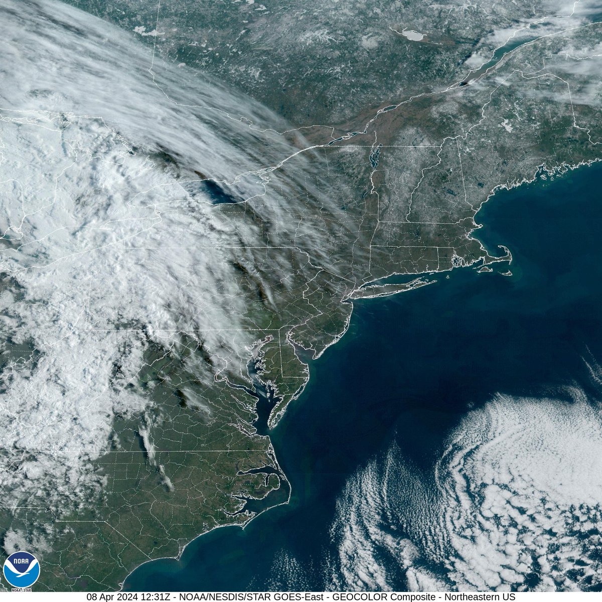
The total solar eclipse is TWO DAYS away. Latest forecast shows best chances for viewing across New England and potentially from northern AR to central IN, though this area has greatest uncertainty due to possible high clouds.

Local forecasts: weather.gov

[4/6/2024} The total solar eclipse is TWO DAYS away. Latest forecast shows best chances for viewing across New England and potentially from northern AR to central IN, though this area has greatest uncertainty due to possible high clouds. Local forecasts: weather.gov
account_circle
CO - Emergency Mgmt(@COEmergency) 's Twitter Profile Photo

Updated posted by Xcel Energy Colorado - '... made the decision to proactively de-energize lines that impact around 55,000 customers, primarily in Boulder County and small sections of Gilpin, Larimer, Douglas, Broomfield and Jefferson Counties.

account_circle
Chris Bianchi(@BianchiWeather) 's Twitter Profile Photo

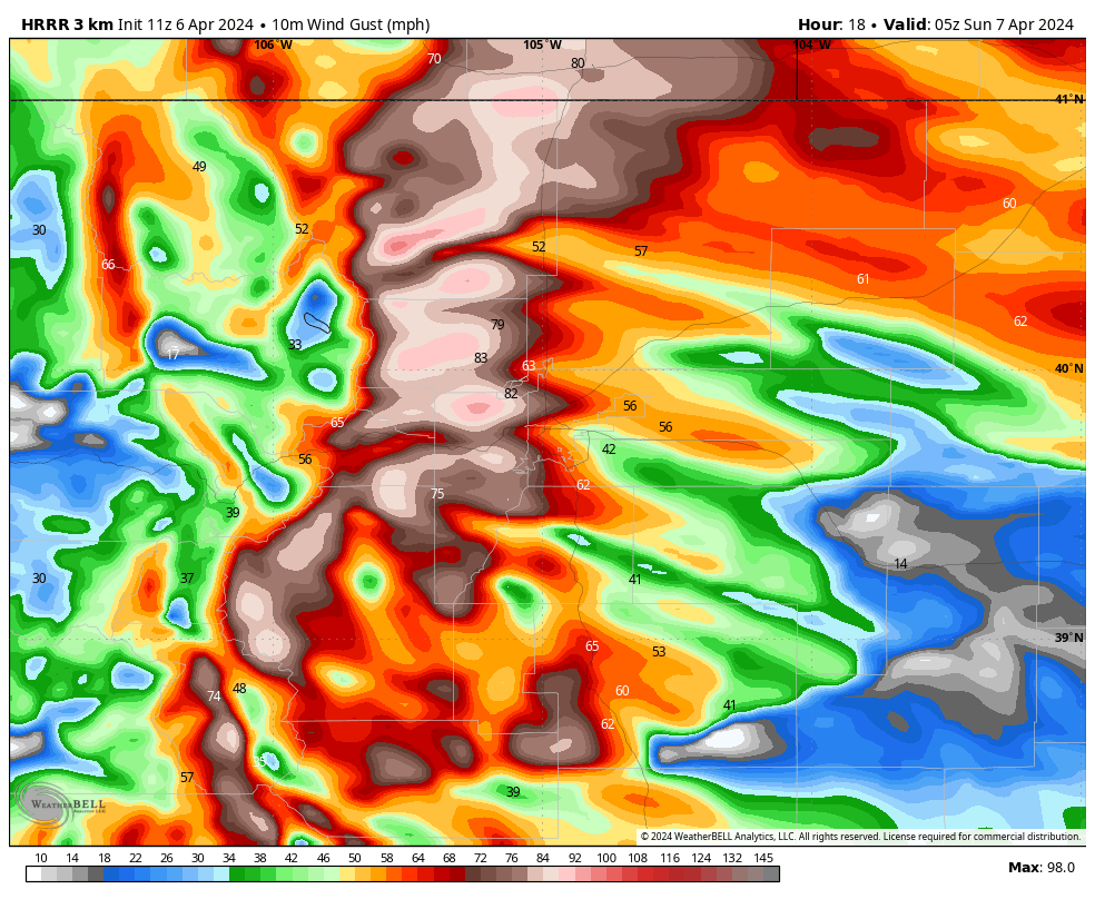
Tonight will potentially be the worst wind storm in the Denver area in years.

100+ mph gusts possible tonight foothills/Highway 93/Boulder/Coal Creek Canyon. Denver peak gusts likely 60-80 mph range late tonight.

Long-lived, with 18+ hours of 60+ gusts possible.

Tonight will potentially be the worst wind storm in the Denver area in years. 100+ mph gusts possible tonight foothills/Highway 93/Boulder/Coal Creek Canyon. Denver peak gusts likely 60-80 mph range late tonight. Long-lived, with 18+ hours of 60+ gusts possible. #COwx
account_circle